Hiking the Mani Peninsula means following ancient stone paths through deep gorges, remote mountain villages and wild coastal landscapes where history, solitude and dramatic scenery combine to create some of the finest walks in mainland Greece.
🪨 Why the Kalderimi Still Matter
Some of the Mani Peninsula’s best walks don’t begin on modern trails.
They begin on kalderimia, the centuries-old stone paths that once linked isolated villages long before roads crossed the peninsula. Built for everyday survival rather than recreation, they remain one of the defining features of hiking in the Mani today.
Walking them is also a way of understanding the landscape.
More Than Historic Footpaths
The routes were carefully engineered to follow the contours of the mountains, avoid unstable ground and connect springs, farmland and settlements. Many still perform those same functions, even if the people using them have changed.
As you walk, look beyond the path itself. Dry-stone terraces, abandoned towers and old retaining walls reveal how closely daily life once depended on these routes.
You’ll often notice:
- 🪨 Original limestone paving
- 🧱 Dry-stone retaining walls
- 🌿 Ancient olive terraces
- 🏰 Tower houses overlooking the routes
- 💧 Springs and former water sources
The kalderimia also explain why many of the Mani’s finest walks feel so natural. Rather than forcing a route through the landscape, they follow lines that local communities refined over generations, making even demanding climbs feel surprisingly logical.
If you’re new to the region, Guide to the Mani Peninsula: Untouched Greece provides the wider historical and geographical context that makes these ancient paths even more rewarding to explore.
🏞️ The Gorge Routes
The Mani’s gorges don’t compete for attention.
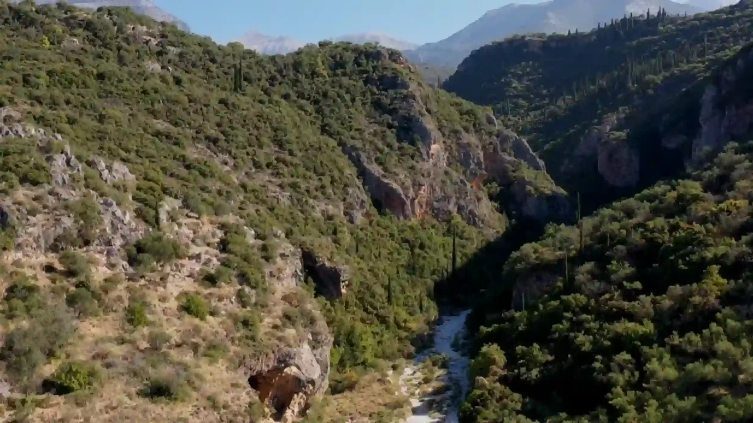
Many are hidden from the road, revealing themselves only after you’ve started walking. From above, the landscape appears dry and exposed. Below, steep limestone walls, seasonal streams and pockets of shade create a completely different environment.
Every gorge has its own character.
Vyros Gorge
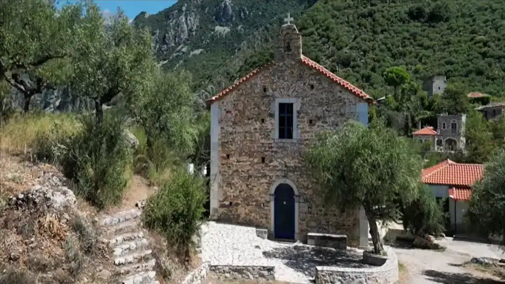
Vyros Gorge is the peninsula’s best-known hiking route and a good introduction to walking in the Mani. The trail links mountain villages with the coast, passing old stone bridges, Byzantine churches and stretches of ancient kalderimi that have survived remarkably well.
Navigation is generally straightforward, although carrying a proper map remains sensible.
The Quieter Ravines
Away from Vyros, several lesser-known gorges attract far fewer walkers. These routes are often steeper, less clearly marked and more demanding, but they reward confident hikers with long periods of genuine solitude.
Rather than rushing through them, allow time to stop. Many of the most impressive views only reveal themselves as the gorge gradually opens towards the sea.
If you’re looking for one of the peninsula’s classic walks, Guide to the Mani Peninsula: Untouched Greece explains how the gorge trails fit into the wider landscape and why they remain one of the defining experiences of the region.
🌊 Coastal Paths and Descents to Hidden Coves
The most rewarding coastal walks in the Mani rarely end at a beach with sunbeds.
Instead, they follow narrow paths that descend from the limestone hills towards small coves where the sea is often the only sound. Some routes are well established. Others feel as though they’ve been waiting quietly for the next walker to arrive.
Preparation matters more than distance.
Cape Tenaro and the Southern Tip
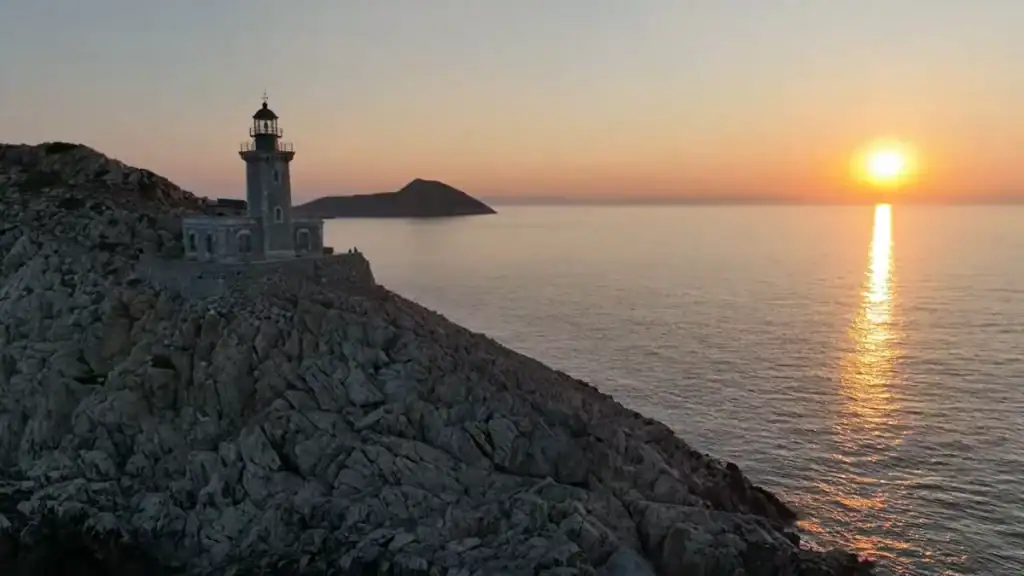
The walk from Porto Kagio to Cape Tenaro is one of the peninsula’s best-known coastal routes. Following a clear path to the lighthouse at mainland Greece’s southernmost point, it combines sea views, archaeological remains and a powerful sense of isolation without demanding difficult navigation.
The Lesser-Known Western Descents
The western coastline offers a different experience. Short but steep paths drop towards secluded pebble coves where facilities are non-existent and mobile reception can be unreliable. Reaching them often involves loose rock and uneven ground, making sturdy footwear essential.
The reward is simple: clear water, dramatic scenery and the feeling that you’ve discovered a corner of Greece that still belongs more to the landscape than to tourism.
If you’re hoping to combine hiking with swimming, The Beaches of the Mani Peninsula highlights the coves and coastal villages that work particularly well as walking destinations rather than straightforward beach stops.
☀️ What the Heat Does to a Walking Day
The Mani Peninsula decides your schedule long before you do.
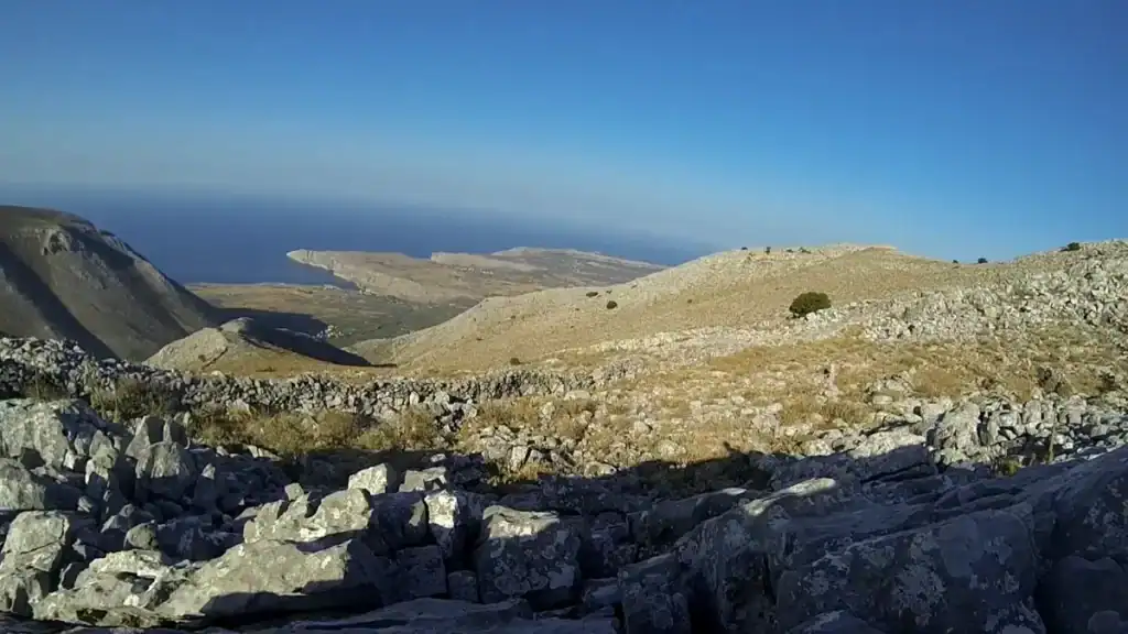
During summer, walking comfortably is less about fitness than timing. Exposed limestone reflects heat, natural shade is limited and many trails offer few opportunities to refill water once you’ve left the villages.
The earlier you begin, the more enjoyable the day becomes.
Plan Around the Temperature, Not the Distance
A route that feels straightforward in April can become surprisingly demanding in July. Experienced walkers often leave shortly after sunrise, aiming to finish exposed sections before late morning and saving cafés, swimming or sightseeing for the hottest hours of the afternoon.
Spring and autumn offer a much wider window for walking, making longer routes far more comfortable.
| Season | Walking Conditions |
|---|---|
| 🌸 Spring | Cool mornings and ideal hiking weather |
| ☀️ Summer | Early starts essential on exposed trails |
| 🍂 Autumn | Warm days with fewer crowds |
| ❄️ Winter | Pleasant temperatures but shorter daylight |
Good planning also means carrying more water than you expect to need. Springs marked on older maps aren’t always reliable, particularly during prolonged dry weather.
If you’re considering a summer visit, Summer in the Mani Peninsula explains how the heat affects hiking, sightseeing and driving, helping you make the most of each day without fighting the climate.
🎒 Gear That Changes the Experience
The right equipment won’t make the Mani Peninsula easier.
It will, however, make long days safer, more comfortable and considerably more enjoyable. The terrain is rarely technical, but loose limestone, uneven stone paths and thorny vegetation quickly expose poor equipment choices.
Prioritise the Essentials
Rather than carrying a heavy pack, focus on a few items that genuinely improve the day.
- 👟 Supportive hiking boots or trail shoes with good grip
- 💧 Plenty of water and a refillable bottle or hydration bladder
- 🧢 Wide-brimmed hat and high-factor sunscreen
- 🗺️ Paper map backed up by offline GPS
- 🩹 Small first-aid kit
- 🥾 Lightweight walking poles for longer descents
Clothing matters too. Lightweight long trousers and sleeves protect against the thorny scrub that borders many trails, while breathable fabrics help manage the peninsula’s intense summer heat.
Navigation deserves particular attention. Mobile apps are useful, but they shouldn’t be your only source of information. Signal can be unreliable in some valleys, and older stone paths don’t always appear accurately on digital maps.
If you’re also planning to drive between trailheads, Driving in the Mani Peninsula: Roads, Turns, and What to Expect explains how the mountain roads influence hiking plans and why journey times are often longer than they first appear.
🤫 Trail Segments Ranked by Solitude
Some trails are popular for a reason.
Others remain surprisingly empty, even during the busiest months. If your ideal walk involves long stretches without seeing another person, the Mani Peninsula still offers places where silence is part of the experience rather than a fortunate coincidence.
| 🥾 Trail | Typical Solitude |
|---|---|
| 🌄 Kita to Vathia Ridge | ★★★★★ |
| 🌊 Western coastal descents | ★★★★☆ |
| 🏞️ Lesser-known gorge routes | ★★★★☆ |
| 🛶 Vyros Gorge | ★★★☆☆ |
| 🚶 Cape Tenaro | ★★☆☆☆ |
The Kita to Vathia ridge consistently feels the most remote. The ancient stone paths cross exposed hillsides, tower houses emerge unexpectedly from the landscape and it’s entirely possible to complete much of the walk without meeting another hiker outside the main holiday season.
By comparison, Cape Tenaro attracts a steady flow of visitors thanks to its lighthouse, mythology and dramatic setting at the southern tip of mainland Greece. It remains an excellent walk, but not one to choose if complete solitude is your priority.
The quieter trails reward a slower pace. Without crowds to keep you moving, there’s time to notice the details that make the Mani distinctive: weathered stone walls, abandoned terraces, distant churches and the changing colours of the limestone as the light shifts through the day.
If you’re looking for a broader introduction before choosing a route, Peace and Quiet in the Mani Peninsula: Is It Really That Empty? explores why this corner of Greece still feels so different from the country’s better-known walking destinations.
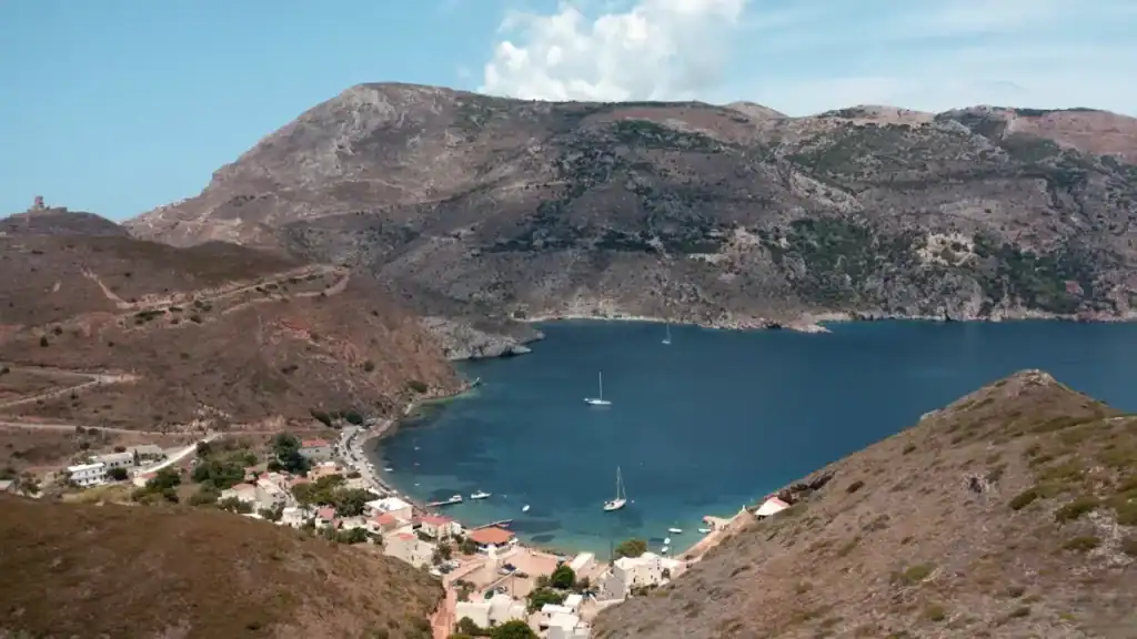
🏔️ The Gorge Routes Above Stavri
The trails above Stavri aren’t the Mani’s most famous walks.
They’re among its quietest.
These routes descend through little-visited gorges towards the western coast, following old stone paths that receive only occasional maintenance. Waymarking is limited, mobile signal can be unreliable and the landscape quickly gives the impression that you’ve stepped well away from the peninsula’s better-known hiking routes.
A Walk for Experienced Hikers
Unlike Vyros Gorge or the Cape Tenaro trail, the paths above Stavri demand greater confidence in navigation. Junctions aren’t always obvious, vegetation occasionally obscures sections of the route and it’s sensible to carry both a paper map and an offline GPS.
The reward is an exceptional sense of solitude.
Ancient churches appear unexpectedly among the hills, abandoned terraces emerge from the scrub and long sections of the route pass through country that feels almost untouched by modern tourism. Rather than presenting history through museums or interpretation boards, the landscape simply leaves it where it has always been.
For walkers who enjoy quieter, less-developed routes, these gorges offer some of the most authentic hiking on the Mani Peninsula.
If you’re planning to explore this part of the peninsula, Guide to the Mani Peninsula: Untouched Greece provides the wider context for the region’s remote villages, history and landscapes, while Peace and Quiet in the Mani Peninsula: Is It Really That Empty? explains why so few visitors venture this far into the deep Mani.