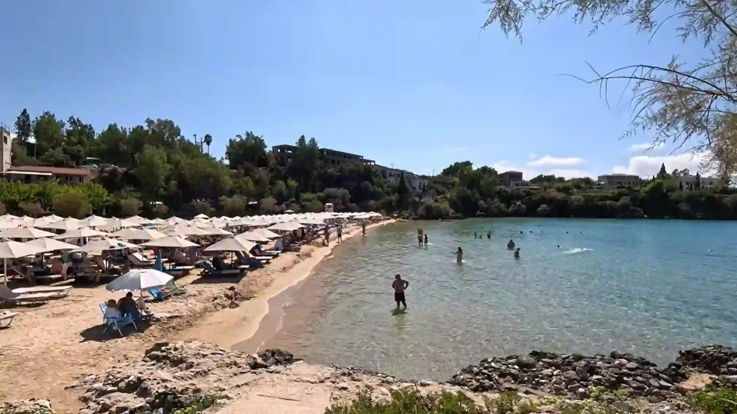
Mani Peninsula beaches are mostly pebbled, remarkably clear and far less developed than those elsewhere in Greece, with sandy exceptions around Stoupa and quieter coves deeper south.
The coastline here is rocky, dramatic, and largely undeveloped. A few sandy exceptions exist and they pull crowds accordingly.
🌊 What the Coastline Actually Looks Like
The first thing to understand is that not all Mani Peninsula beaches are alike.
The western coastline around Kardamyli and Stoupa offers the peninsula’s best-known beaches, while the Deep Mani becomes progressively wilder as you travel south. Throughout the region, dramatic limestone scenery replaces long stretches of sand, creating a coastline that feels far more natural than many of Greece’s popular holiday destinations.
Pebble Beaches Are the Norm
If you’re expecting endless golden sand, you’ll be surprised.
Most beaches consist of smooth white or grey pebbles that slope gently into exceptionally clear water. Beach shoes make walking more comfortable, but the reward is cleaner water and far less sand being stirred up by waves.
Only a handful of beaches, particularly around Stoupa, break this pattern.
Why the Water Is So Clear
One feature almost every visitor comments on is the remarkable water clarity.
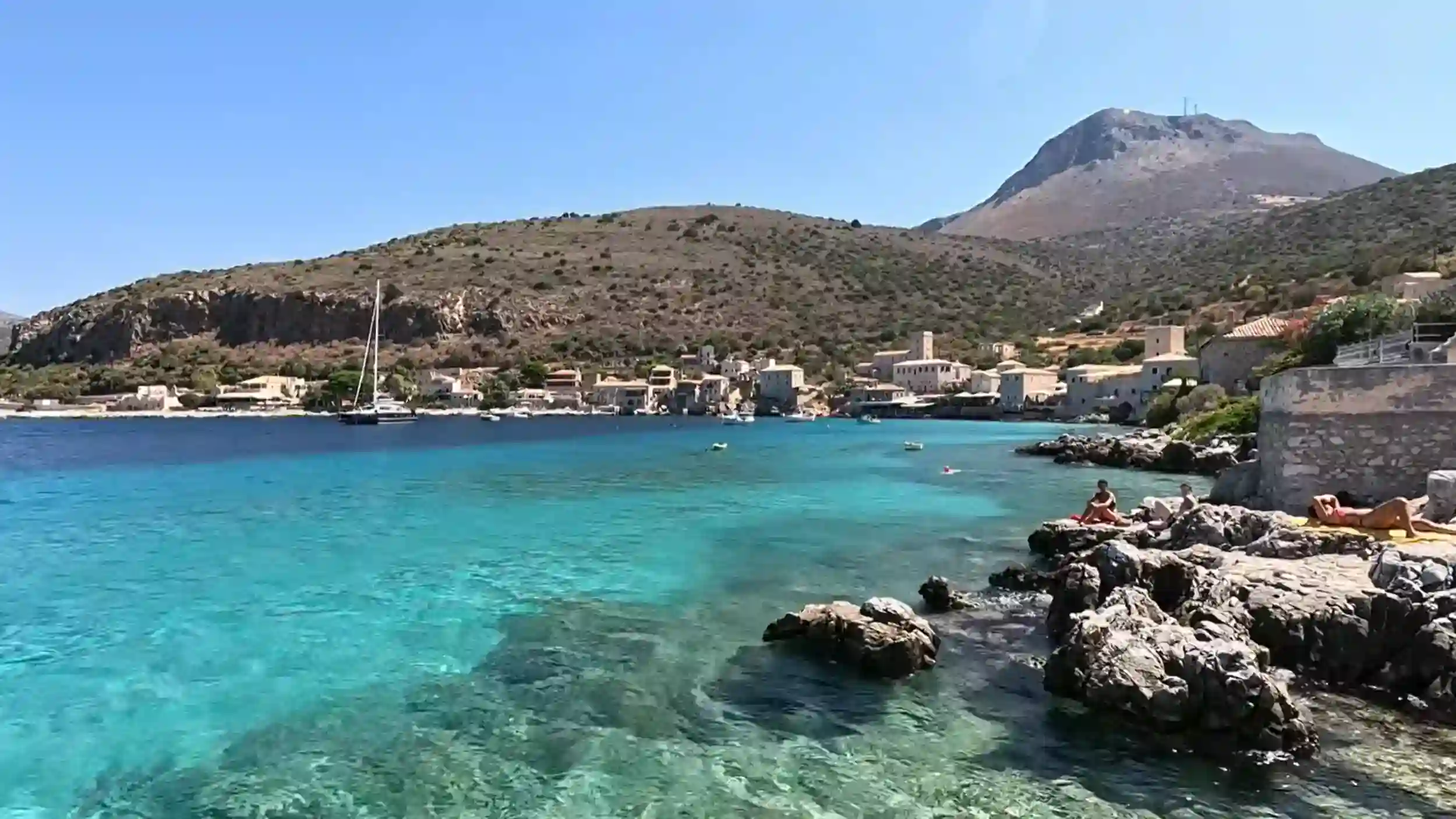
Without large rivers carrying sediment into the sea and with relatively little boat traffic across much of the peninsula, visibility beneath the surface is often outstanding. On calm mornings it’s common to see the seabed many metres below, even from the shoreline.
The colours change constantly throughout the day.
Shallow water glows turquoise beside the rocks before gradually deepening to rich shades of blue further offshore, particularly along the more rugged southern coastline.
Good to know: Most beaches remain completely natural, with far fewer organised facilities than you’ll find in many other parts of Greece.
If you’re planning to explore more than just the coastline, Guide to the Mani Peninsula: Untouched Greece explains how the beaches fit into the peninsula’s wider landscape of mountain villages, historic towers and spectacular coastal drives.
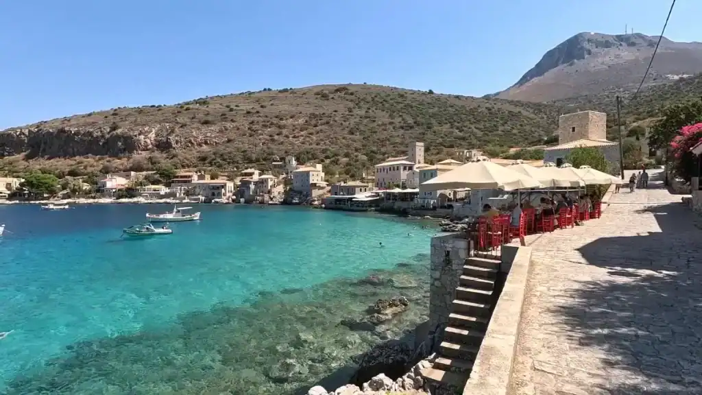
🏖️ The Beaches Around Kardamyli and Stoupa
If you’re visiting the Mani Peninsula primarily for swimming, this is where you’ll probably spend most of your time.
The stretch of coastline between Kardamyli and Stoupa contains the peninsula’s largest concentration of accessible beaches, along with the best choice of cafés, tavernas and nearby accommodation. It also happens to include the Mani’s best-known sandy beaches.
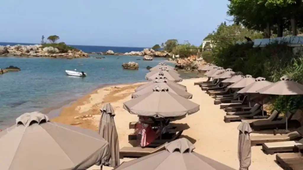
Stoupa Beach
Stoupa Beach is one of the few places on the peninsula where soft sand replaces pebbles. The gently shelving water makes it popular with families, while restaurants and cafés are only a short walk away.
During July and August it becomes one of the busiest beaches in the Mani.
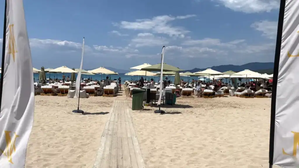
Kalogria Beach
Just around the headland, Kalogria Beach offers another sandy bay with calm, turquoise water. It’s slightly more sheltered than Stoupa Beach and remains a favourite for swimming and paddleboarding.
Sunbeds are available during summer, although arriving early is worthwhile in peak season.
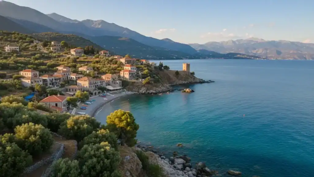
Kardamyli’s Waterfront
Kardamyli doesn’t have a broad beach in the traditional sense.
Instead, visitors swim from narrow pebble shores and rocky platforms beneath the old town, with the Taygetos Mountains providing a spectacular backdrop. The scenery often becomes the highlight rather than the beach itself.
For a quieter alternative nearby, Kalamitsi Beach offers a sheltered pebble cove with clear water and noticeably fewer visitors than Stoupa.
| Beach | Best For |
|---|---|
| 🏖️ Stoupa | Families and sandy swimming |
| 🌊 Kalogria | Calm water and sunbathing |
| 🪨 Kardamyli | Scenic swimming and waterfront cafés |
| 🌿 Kalamitsi | Quieter pebble beach |
If you’re planning to combine swimming with walking, Hiking the Mani Peninsula: Stone Paths and Silent Gorges highlights several coastal trails that finish close to some of the peninsula’s most rewarding beaches.
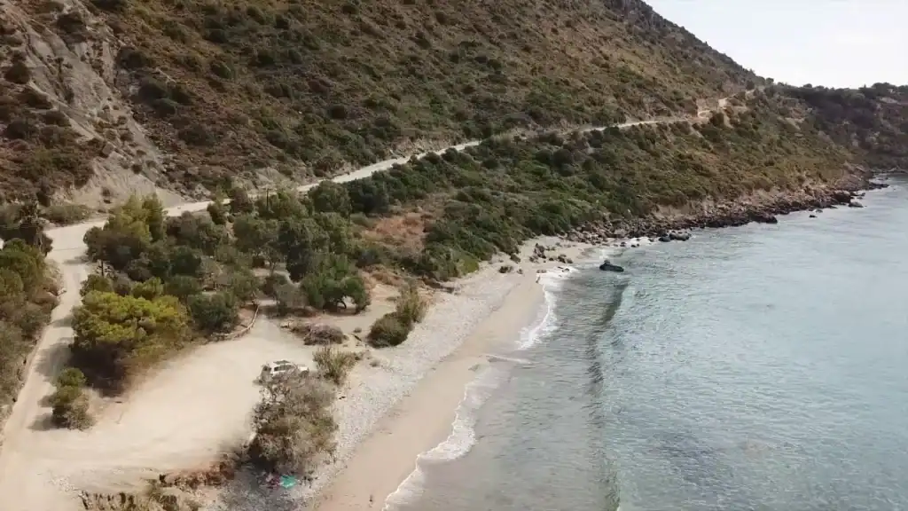
🌅 Limeni and the Deep Mani Coast
South of Areopoli, the coastline becomes noticeably quieter.
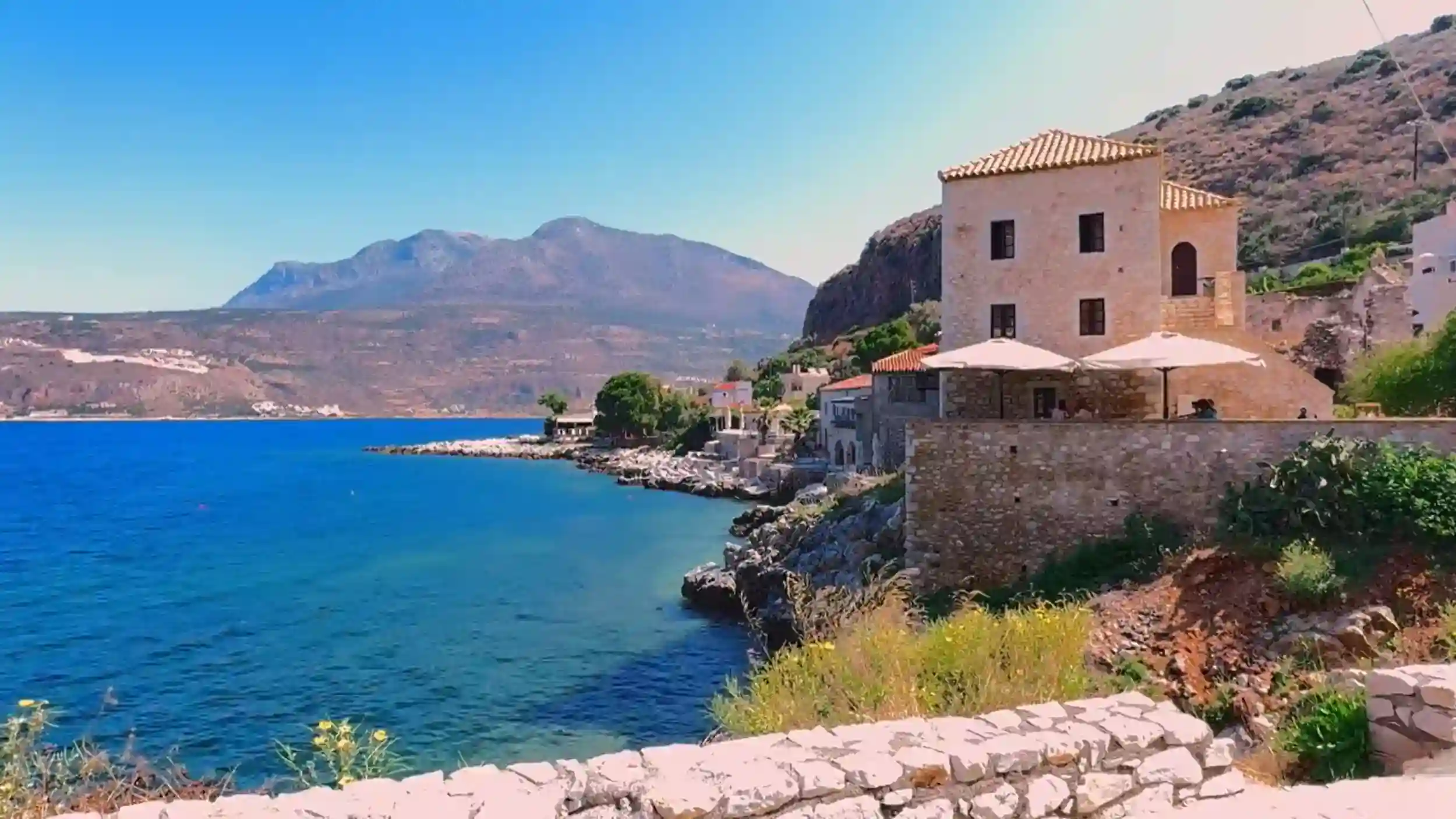
The broad beaches around Stoupa give way to rocky inlets, tiny coves and traditional fishing villages where swimming is often from stone jetties rather than long stretches of shoreline. It’s a landscape that rewards travellers looking for scenery and tranquillity rather than organised beach resorts.
Limeni: Swim in One of Greece’s Clearest Bays
Limeni is one of the Mani Peninsula’s most photographed locations, and deservedly so.
Stone houses line the waterfront, tavernas sit directly above the sea and the water is astonishingly clear. There isn’t a conventional beach here. Instead, visitors enter the sea from smooth rocks, small platforms and low jetties.
Arriving early makes a noticeable difference during summer, particularly if you’re hoping to park close to the harbour.
Mezapos and the Hidden Coves
Continue south and the coast becomes even more rugged.
Mezapos offers a sheltered pebble cove surrounded by limestone cliffs, while smaller unnamed inlets appear between headlands further towards Cape Tainaron. Reaching some of them involves short walks or rough access roads, but that’s precisely why they remain so peaceful.
| 📍 Location | What to Expect |
|---|---|
| 🌊 Limeni | Crystal-clear water and waterfront swimming |
| 🚤 Mezapos | Sheltered cove and excellent snorkelling |
| 🪨 Southern coves | Quiet pebble beaches with few facilities |
| 📷 Foneas Beach | Dramatic scenery and deep, clear water |
The further south you travel, the less developed the coastline becomes. Facilities grow fewer, but so do the crowds, creating the sense that you’ve reached a very different side of the Mani Peninsula.
If you’re exploring beyond the beaches, Guide to the Mani Peninsula: Untouched Greece explains how Limeni, Areopoli and the Deep Mani fit together as part of a wider journey through the peninsula.
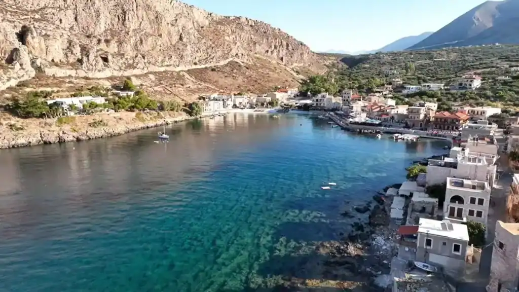
⚓ Gerolimenas and the Southern Beaches
Gerolimenas marks a turning point.
Beyond here, the Mani Peninsula feels wilder, quieter and increasingly remote. The coastline narrows, villages become smaller and many beaches seem almost hidden between the limestone cliffs that dominate the southern tip of mainland Greece.
Gerolimenas Harbour
Although Gerolimenas has a small pebble beach, the setting is what draws most visitors.
Traditional stone buildings overlook a sheltered harbour where the water is calm enough for swimming and snorkelling. Taverns line the waterfront, making it easy to spend several relaxed hours here without feeling rushed.
Outside July and August, the village often feels remarkably peaceful.
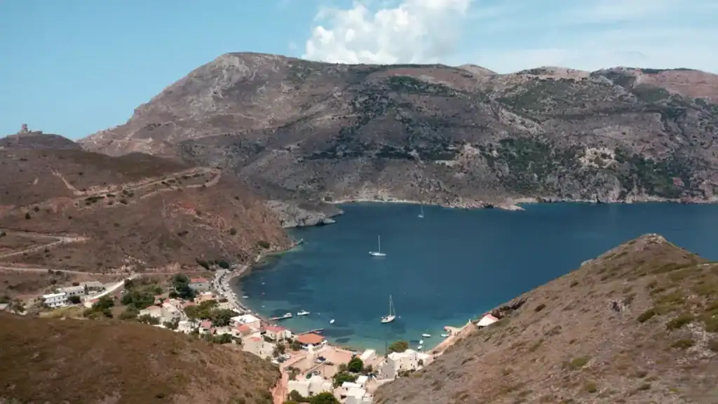
Porto Kagio
Further south lies Porto Kagio, a tiny fishing village tucked into a protected bay close to Cape Tainaron.
The beach itself is small and pebbly, but the combination of turquoise water, moored fishing boats and the dramatic mountain backdrop makes it one of the peninsula’s most atmospheric locations.
Many visitors also continue on foot to the lighthouse at Cape Tainaron.
Beaches Worth the Detour
Not every rewarding beach has a name on the map.
Some of the quietest coves are reached via narrow lanes or short walks from roadside pull-offs, rewarding those willing to leave the main road behind.
Expect fewer facilities the further south you travel.
Many beaches have no sunbeds, cafés or lifeguards, so carrying water and refreshments is a sensible idea.
If you’re planning to continue beyond Porto Kagio, Driving in the Mani Peninsula: Roads, Turns, and What to Expect explains what the southern roads are really like and why journey times are often longer than they first appear.
🚗 Parking, Access, and What to Expect on Arrival
The easiest beaches to reach are also the busiest.
Stoupa and Kalogria have dedicated parking, short walks to the water and facilities within a few minutes, making them ideal for families or anyone carrying plenty of beach gear.
Elsewhere, expectations need to change.
Easy Access Beaches
If convenience is your priority, focus on the northern part of the peninsula.
Parking is generally straightforward around Stoupa, while Kalamitsi also offers relatively simple access without a long walk to the shoreline. These beaches suit visitors who want to swim without tackling rough paths or steep descents.
The Deep Mani Is Different
South of Areopoli, parking often means using roadside pull-offs or small gravel areas rather than formal car parks. From there, a short walk usually leads to the beach, although the quality of the paths varies considerably.
Some are little more than rocky tracks.
Others involve uneven stone steps or loose ground, making sensible footwear worthwhile even if you’re only carrying a towel.
| Beach Area | Parking & Access |
|---|---|
| 🏖️ Stoupa | Large car parks and easy access |
| 🌊 Kalogria | Short walk from parking |
| 🪨 Limeni | Limited roadside parking |
| 🚤 Gerolimenas | Small parking areas near the harbour |
| 🌿 Remote coves | Informal parking and rough footpaths |
Planning tip
If you’re driving to the Deep Mani’s quieter beaches, it’s worth reading Driving in the Mani Peninsula: Roads, Turns, and What to Expect before setting out. It explains why navigation apps often underestimate journey times once the roads narrow towards the southern coast.
📅 How Busy It Gets and When
A beach that feels wonderfully peaceful in May can look very different six weeks later.
The busiest period across the Mani Peninsula runs through July and August, although the increase in visitors is concentrated in only a handful of locations rather than the entire coastline.
The Outer Mani in Summer
Stoupa and Kalogria experience the biggest seasonal change. Parking fills early, restaurants become busier and finding space on the sand is noticeably harder by late morning.
That’s hardly surprising. They’re the peninsula’s easiest beaches to reach and among its few sandy options.
The Deep Mani Stays Surprisingly Quiet
Drive south of Areopoli and the atmosphere changes.
Even during peak season, many pebble coves attract only a handful of swimmers because they’re less obvious to find and require a little more effort to reach. Rather than rows of umbrellas, you’re more likely to find natural shade, fishing boats and long periods of uninterrupted quiet.
| Area | Peak Season Feel |
|---|---|
| 🏖️ Stoupa & Kalogria | Lively and busiest |
| 🌊 Kardamyli | Popular but manageable |
| ⚓ Limeni | Busy around lunchtime |
| 🪨 Gerolimenas | Usually relaxed |
| 🌿 Deep Mani coves | Often quiet, even in August |
Worth remembering
Visitors who choose the Mani for its coastline are usually looking for something different from a classic beach holiday. If your priority is space, scenery and clear water rather than beach clubs and entertainment, the quieter southern coast is often the more rewarding choice.
📖 Also worth reading: Summer in the Mani Peninsula: Heat, Light, and Daily Rhythm explains how the season affects beaches, sightseeing and driving, while Guide to the Mani Peninsula: Untouched Greece helps you decide which part of the peninsula best suits your style of travel.