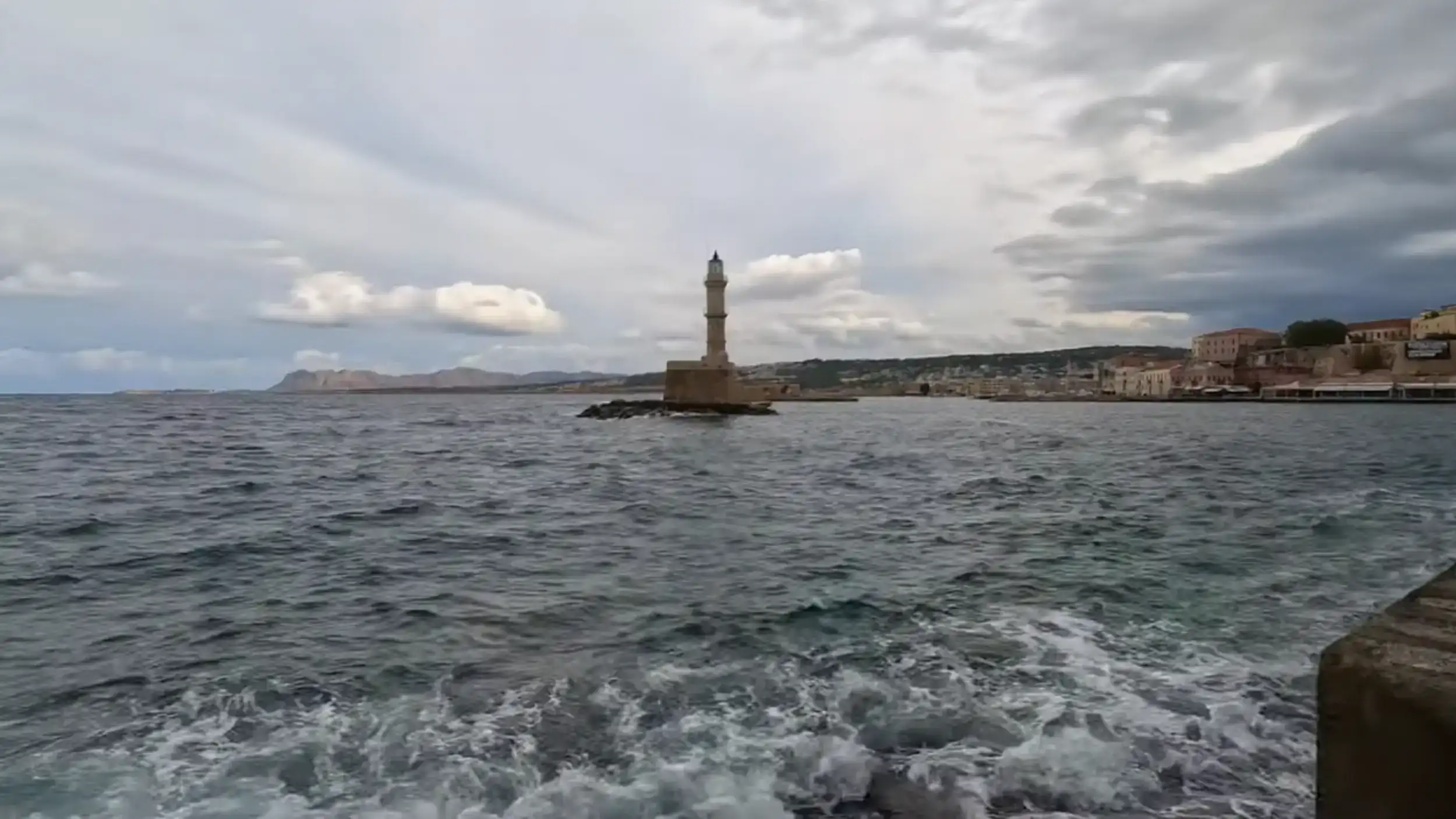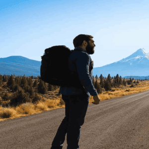
The White Mountains rise directly behind Chania. On clear days from the harbour, snow sits on the upper ridges while the sea below is warm enough for swimming. That contrast defines what makes Crete’s White Mountains worth understanding before you visit.
What the White Mountains Actually Are
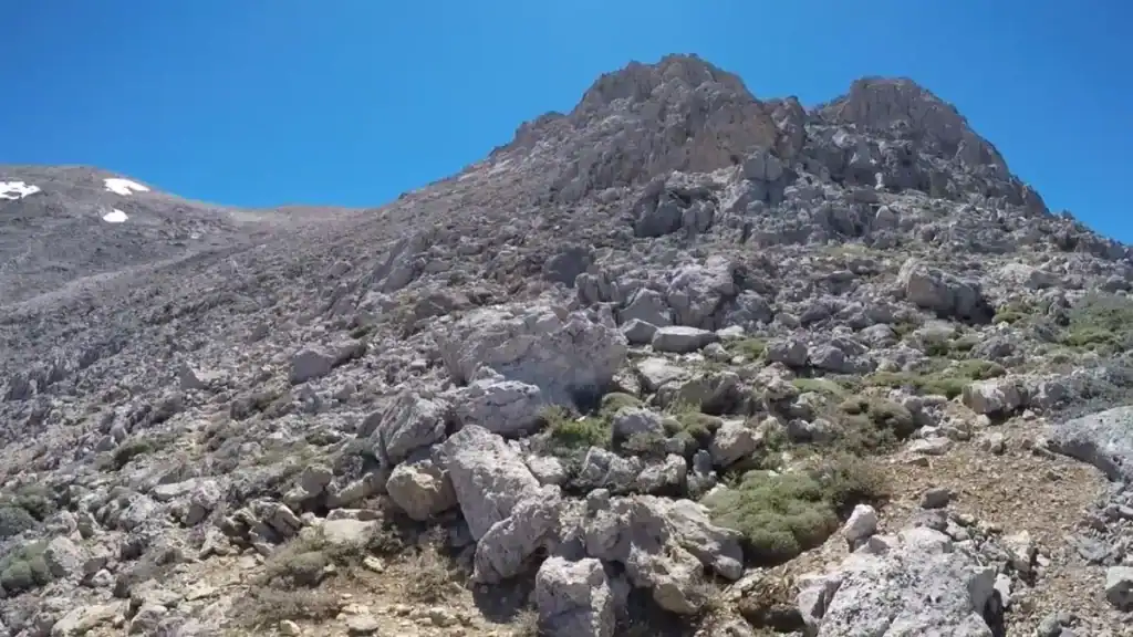
The Lefka Ori, meaning white or bare, take their name from the exposed limestone above roughly 1,800 metres. The mountain range covers the western third of Crete and forms the backbone of the area south of Chania. Peaks exceed 2,000 metres. The summit of Pachnes reaches 2,453 metres, the highest point in the range.
The geology is limestone throughout. The rock was formed over millions of years as tectonic plates collided, and Crete continues to rise slowly. The same forces that built the mountains carved the landscape around them. Around a hundred gorges drain the massif, many concentrated in the Sfakia region to the south. The Libyan Sea receives their water eventually.
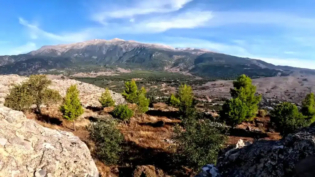
From Chania, the range is visible as a constant backdrop. In late spring it holds snow on the upper ridges while olive groves on the lower slopes are already in leaf. By July the high desert terrain above 2,000 metres is fully exposed, bare rock and scattered scrub under intense sun. The mountain air changes with altitude. An hour’s drive south of Chania moves through several distinct climate zones.
The Gorges and the Trails
The White Mountains are best known internationally for their gorges. The most accessible entry point for most visitors is the Omalos plateau, which sits at around 1,050 metres south of Chania and serves as the northern entrance to the Samaria National Park.
Samaria Gorge
The Samaria Gorge is 16km long and cuts through the range from Xyloskalo on the Omalos plateau to Agia Roumeli on the south coast. It is the longest gorge in Europe by most classifications. The trail descends over 1,000 metres. Narrow passages at the Iron Gates reduce the gorge to around three metres wide. The hike takes between four and seven hours depending on pace.
Agia Irini Gorge
The Agia Irini Gorge runs roughly 8km and is less demanding than Samaria. It starts near the village of Agia Irini south of Chania and ends near Sougia on the south coast. It suits walkers who want a gorge experience without the full commitment of Samaria. Plane trees and oleander line the lower sections. The trail is well marked and manageable for reasonably fit walkers.
Aradena Gorge
The Aradena Gorge descends from the plateau village of Aradena to the south coast near Loutro. It is shorter but technically more demanding than Samaria, with fixed ropes required at one descent point. The village of Aradena above the gorge was largely abandoned after a vendetta between two families in 1948. The Bailey bridge spanning the gorge was installed during the Second World War. In summer, bungee jumping operates from the bridge. The gorge itself is quiet, less visited than Samaria, and genuinely different in character.
The E4 Trail and Higher Routes
The E4 trail is a European long-distance path that crosses Crete from east to west, passing through the White Mountains. The section through the range runs from the Askifou plateau across the Madares high plateau and down toward the south coast. It is marked by yellow and black waymarks and covers terrain that ranges from manageable mountain paths to exposed limestone karst.
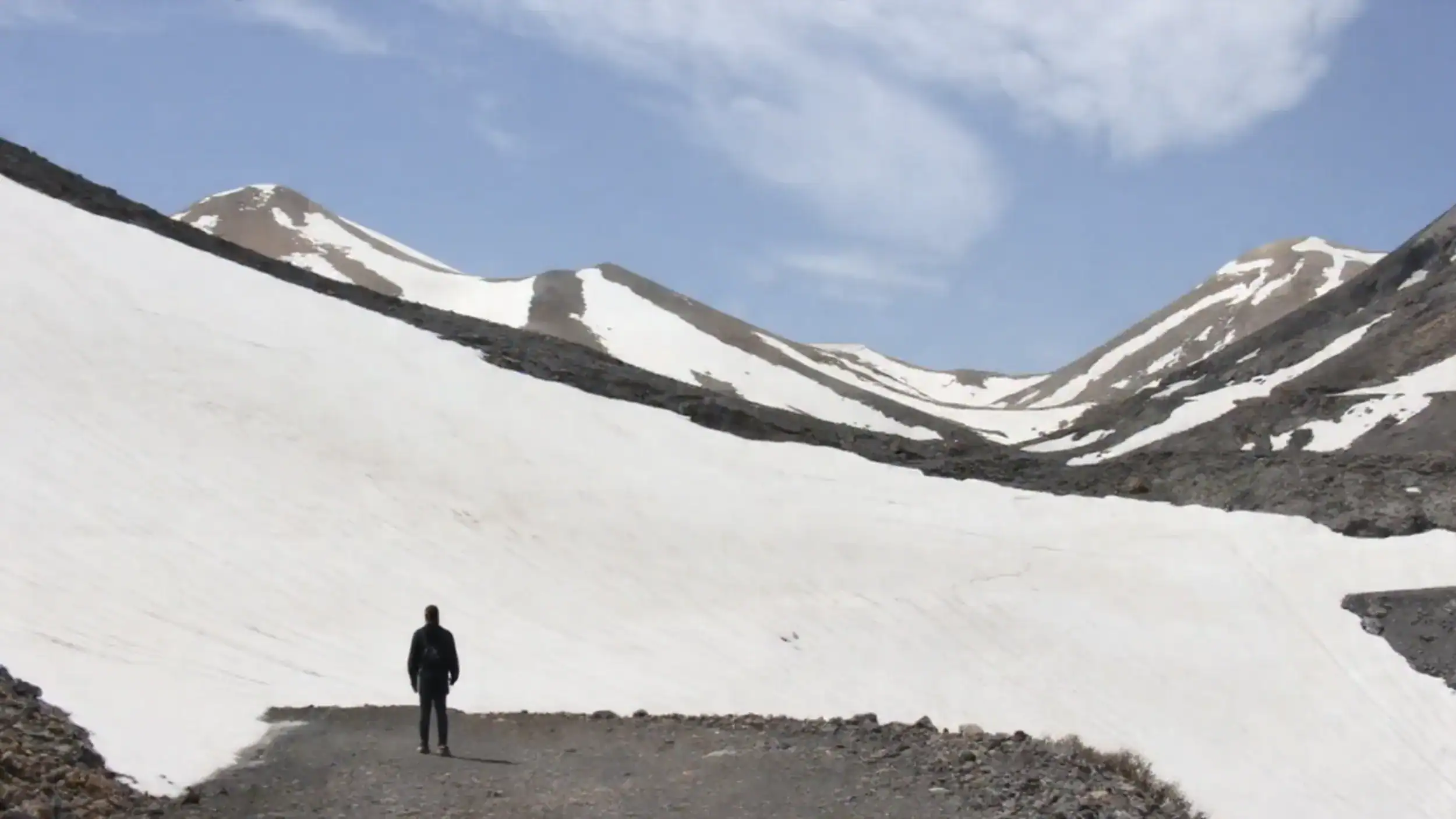
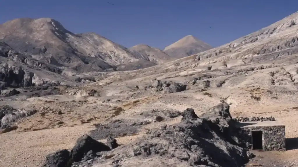
The Madares is the high plateau at the centre of the range, roughly centred around 2,000 metres. It is a high desert landscape: bare rock, sparse vegetation, no permanent water sources in summer. Navigation requires map and compass skills or a GPS device. The E4 trail through this section is for experienced hikers with appropriate equipment.
The Kallergi Refuge sits above the Omalos plateau at around 1,680 metres and provides the main mountain hut accommodation in the range. It is staffed in season, offers basic dormitory accommodation and meals, and serves as a base for the ascent of Gingilos, one of the more dramatic peaks above the Samaria Gorge rim. Gingilos requires scrambling on exposed rock and should not be attempted by walkers without experience on technical terrain.
Reaching the Summit of Pachnes
Reaching the summit of Pachnes is a serious undertaking. The standard approach starts from the Askifou plateau, climbs through the Madares, and gains the summit ridge after several hours of high altitude walking on loose limestone. The route is marked by cairns but not engineered. Snow can block the upper approach into May. A stone shelter sits near the top.
From the summit, views extend across the Samaria Gorge, the Aradena chasm, Frangokastello on the south coast, and on clear days toward Rethymno to the east. The hike to the summit and back takes a full day from the Askifou plateau. Carry sufficient water. Springs are spaced according to terrain and some dry in summer.
The Plateau Villages and Middle Altitude
Below the exposed ridges, a middle altitude zone runs through the range at between 500 and 1,000 metres. This is where the human history of the mountains becomes visible. Villages such as Anopolis, Askifou and the settlements around the Askifou plateau supported substantial populations in previous centuries. The terraces, stone walls and collapsed dwellings visible throughout this zone mark a landscape that was once intensively farmed.
The natural beauty of this middle zone is different from the drama of the gorges or the scale of the summit terrain. Olive groves give way to phrygana scrub. Cypress trees grow slowly from thin soil. Beehives are positioned for access to the seasonal flowering as it moves uphill through spring and early summer. The honey changes with elevation. Traditional Cretan food in the tavernas and small restaurants in these villages uses ingredients from the surrounding landscape directly.
Manousakis winery operates in the foothills of the range near Vatolakkos, producing wine from Cretan varieties including Kotsifali and Romeiko. It represents the lower elevation version of the same mountain landscape that produces the honey further up. Both are worth knowing about if your itinerary includes a day trip south of Chania.
Season and Access
Late spring and early autumn offer the most reliable conditions for hiking in the White Mountains. Late April to early June gives access to most gorge routes with water still running, wildflowers in bloom, and temperatures manageable at altitude.
July and August are viable at higher elevations but brutal in the gorges by mid-morning. The approach from Agia Roumeli to Eligias Gorge follows exposed beach and requires an early start. Gorge exits on the south coast require either a ferry back to Hora Sfakion or an overnight in Agia Roumeli, Loutro or another south coast settlement.
Snow closes the Samaria Gorge and the higher routes from approximately November to late April. The Omalos plateau road can be blocked by snow in winter. The Kallergi Refuge closes for the winter season. Lower altitude routes and the Agia Irini Gorge remain accessible in most winters when conditions are dry.
Getting into the Mountains from Chania
The Omalos plateau is around an hour’s drive from Chania. Buses run from Chania to Omalos in the hiking season, primarily for the Samaria Gorge. For the Aradena Gorge, Anopolis and the Askifou plateau, a rental car is the most practical option. The roads are paved throughout but narrow in places.
The wider reach of the landscape around Chania, from the coast to the high ridges, gives the city a different scale from most Greek island bases. The mountains are not a backdrop. They are a destination in their own right, accessible within an hour and capable of filling multiple days at any level of ambition.
Frangokastello and the South Coast
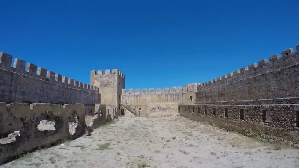
Frangokastello is a Venetian castle on the south coast, built in the 14th century at the base of the mountains. From Zaranokefala above, the castle and the coast are visible between the ridges. From the coast looking up, the scale of the range is clear in a way it is not from the north. The drive from Chania takes around an hour. The beach beside the castle is shallow and calm.
The south coast settlements of Loutro, Agia Roumeli and Hora Sfakion are accessible by ferry in season. Loutro has no road access at all. These villages exist in a different relationship to the mountains than Chania does, enclosed by the range rather than facing away from it. Spending a night on the south coast during a hiking itinerary changes the sense of scale entirely.
Related Content:
Chania Beyond the Old Town: Discovering Hidden Corners
How Challenging Is the Samaria Gorge Hike?