Alcácer do Sal sits thirty kilometres east of Comporta on the Sado river, a Moorish hilltop town with a castle, salt history, and storks that most coast visitors never reach.
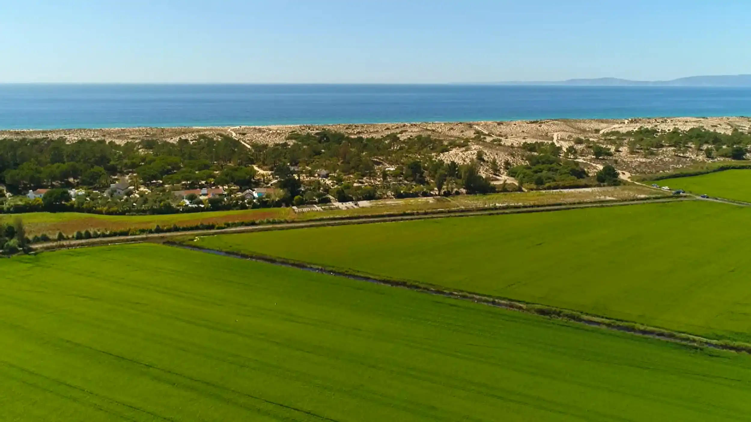
The drive from Comporta takes around thirty minutes. The landscape changes clearly along the way. Pine forest and dune scrub give way to the Sado floodplain, where rice fields spread out on both sides of the road, their shallow water reflecting sky depending on the time of day. By the time the castle hill appears in the distance the coast already feels far behind.
The Bridge and the Riverfront
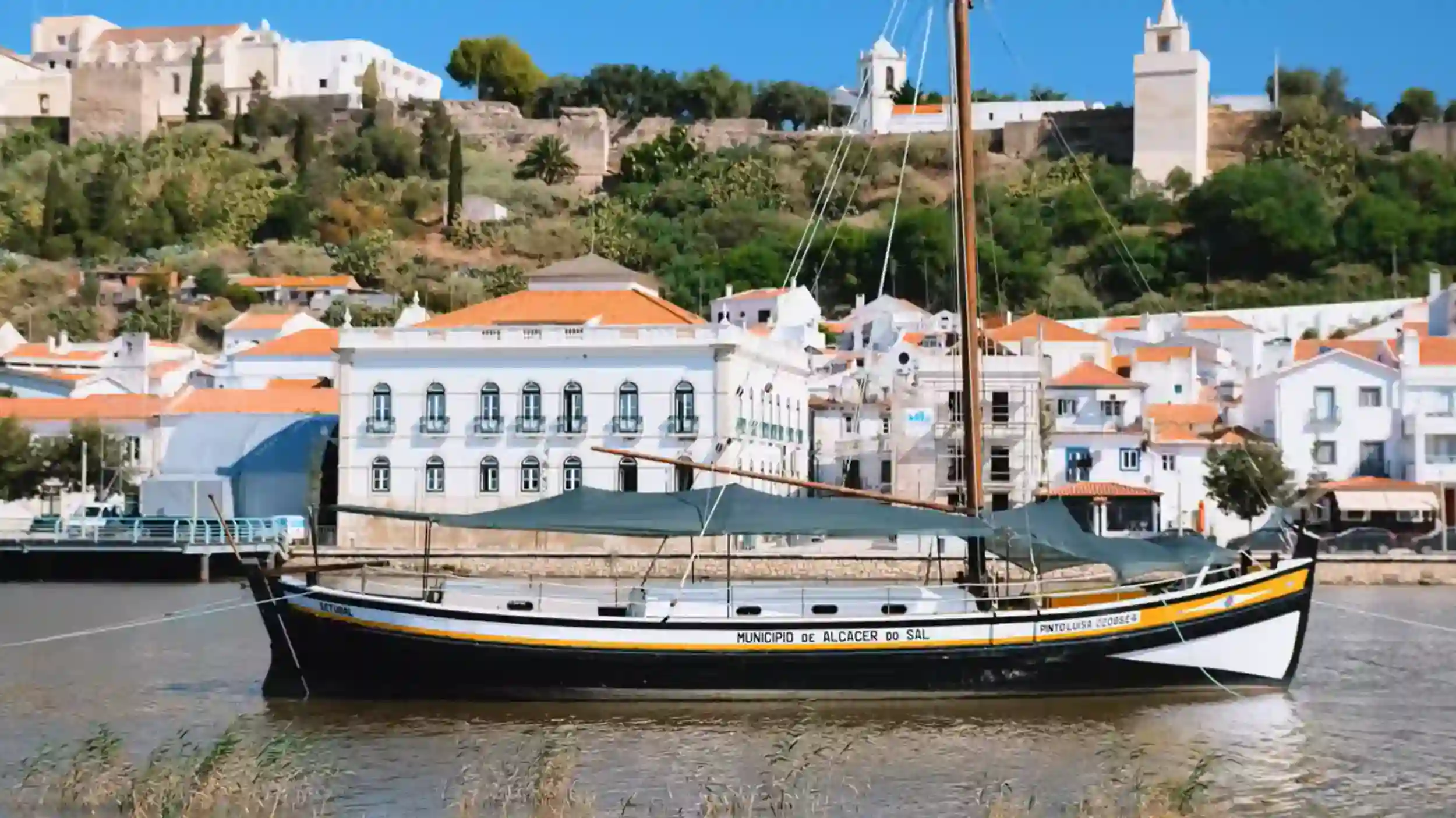
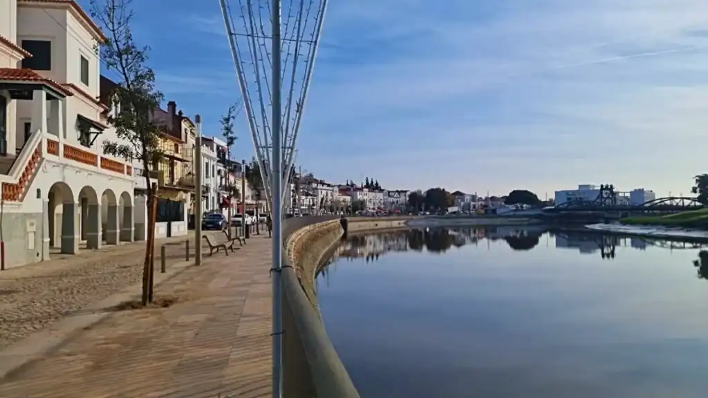
Crossing the Sado bridge is the clearest introduction to the town’s setting. The river runs wider than expected here, slow and deliberate as it moves toward the estuary. Stork nests sit on electricity pylons and on the stone edges of the castle ramparts above, large enough to read clearly from the bridge without searching for them.
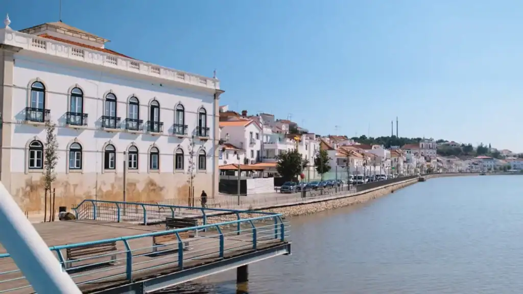
The town steps down from the castle hill to a long riverfront promenade on the north bank. Whitewashed buildings face the water, many carrying wrought iron balconies. Cafes occupy the obvious positions along the waterfront. The promenade has the slightly mixed character of a town that serves its residents first: a small park, a skate ramp, a motorhome area alongside the more photogenic stretches of waterfront. None of it feels staged.
Parking near the river is easy. Most visitors leave the car there and walk uphill toward the castle.
The Castle Hill
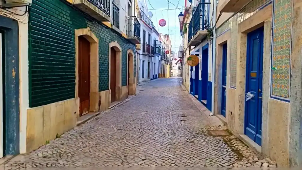
The climb from the riverfront takes only a few minutes, but the streets tighten as they rise. The lanes are cobbled and narrow, shaded in places where buildings lean inward. The arrangement carries a faint resemblance to Lisbon’s older neighbourhoods, though at a fraction of the scale and with considerably less traffic.
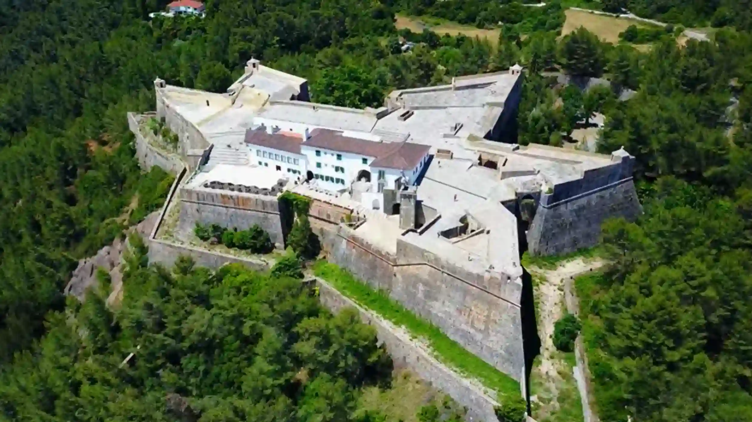
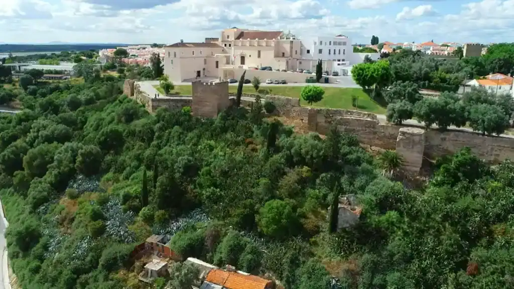
The Pousada Dom Afonso II
The Pousada Dom Afonso II occupies the old Carmelite convent established here in the sixteenth century. The convent functioned until 1834 before eventually being incorporated into the pousada complex. Non-guests can walk the castle grounds freely, which means access to the terrace without a room booking.
From that height the Sado valley opens widely below the town. Rice fields extend across the floodplain in neat geometric sections and the Alentejo plain stretches beyond them. Late afternoon light reaches the paddies at a shallow angle that makes the water inside them reflective. The timing improves the view noticeably, though it is not the kind of thing you can easily plan for on a first visit.
The Archaeological Crypt
Beneath the pousada, the Archaeological Crypt opened in 2008 following excavation work carried out during the building’s renovation. The entrance is discreet enough that several visitors walk past it without noticing.
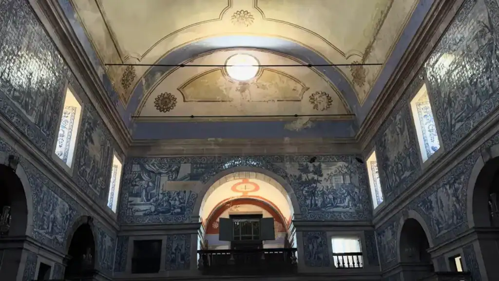
Inside, the layers of occupation read almost like a cross-section through time. Iron Age structures sit at the base. Roman construction was added above them, followed by Islamic defensive walls and later medieval Christian additions. Some of the Roman columns now standing in the Church of Santa Maria do Castelo originally belonged to an earlier temple on the same hill. It is a compact way of understanding how long this particular hill has been inhabited and why it kept attracting successive civilisations.
Three Thousand Years Beneath the Streets
The town’s name is a compressed piece of its own history. Alcácer derives from the Arabic Al-Qasr, meaning fortress. Do Sal reflects the Latin word for salt. The name already describes the place before you arrive.
Phoenician traders established a settlement here roughly three thousand years ago, known as Bevipo. Salt and salted fish moved out through Mediterranean trade routes alongside horses from the surrounding region. When Roman expansion reached the area the town was renamed Salacia after the goddess of salt water, prosperous enough to mint its own coins marked Imperatoria Salacia.
The importance of the Sado as a port declined as Lisbon gained influence further west. The town contracted but never disappeared. Muslim forces entered the region in the early eighth century, rebuilt the hilltop fortress, and reorganised the settlement below it. The upper town served administrative and military functions while the lower town continued operating as a port. By the ninth century Al-Qasr controlled a significant stretch of surrounding territory, and Lisbon itself was said to pay tribute here.
The Portuguese reconquest unfolded gradually. By 1217 the town had been secured with assistance from the Order of Santiago, which established its headquarters here and left traces across the town that remain visible today in churches including the Church of Santiago.
Walking back down toward the river, very little of this history is aggressively explained on the streets themselves. The town hall sits on a square lined with palm trees. A statue of the mathematician Pedro Nunes, born here in 1502, stands nearby. One street behind the polished riverfront the buildings feel older and less curated. Shops open onto narrow streets where locals are clearly going about ordinary routines. The town simply continues operating.

The Salt Pans and the Estuary
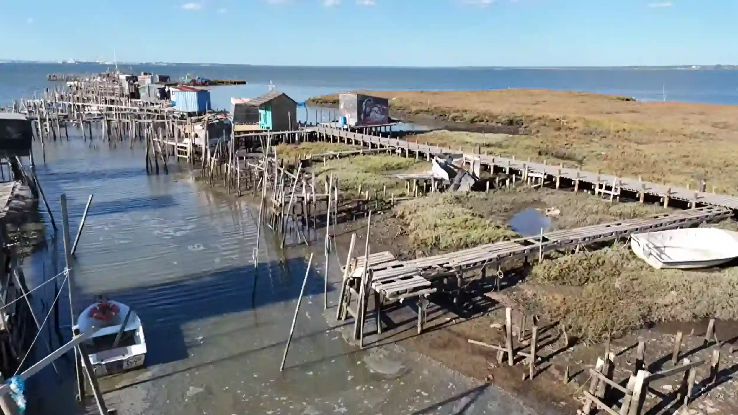
The salt that once defined the town’s economy has mostly left the landscape. From the eighteenth century onward the estuary’s salt pans were gradually converted into rice fields, a process that accelerated during the twentieth century as irrigation systems improved along the Sado’s tributaries. Today only one traditional salt pan remains active nearby. Salina da Batalha sits on the left bank of the river a short distance from town and offers guided visits.
The surrounding estuary forms part of the Reserva Natural do Sado, a protected landscape extending west toward the coast. Birdlife is abundant across the floodplain. White storks dominate the skyline around town but they are only the most visible species. Flamingos appear seasonally across the salt flats and marshes further out. The estuary supports a resident dolphin colony, though seeing them from town requires heading out by boat toward Marina de Tróia.
The terrain shifts once the houses thin out on the edge of town. Evaporation basins form pale rectangular surfaces separated by narrow channels. Marsh grasses grow around the edges and the air carries a different quality away from the streets. Even when Alcácer do Sal itself is quiet, the flats carry a heavier silence.
What Comporta Doesn’t Have
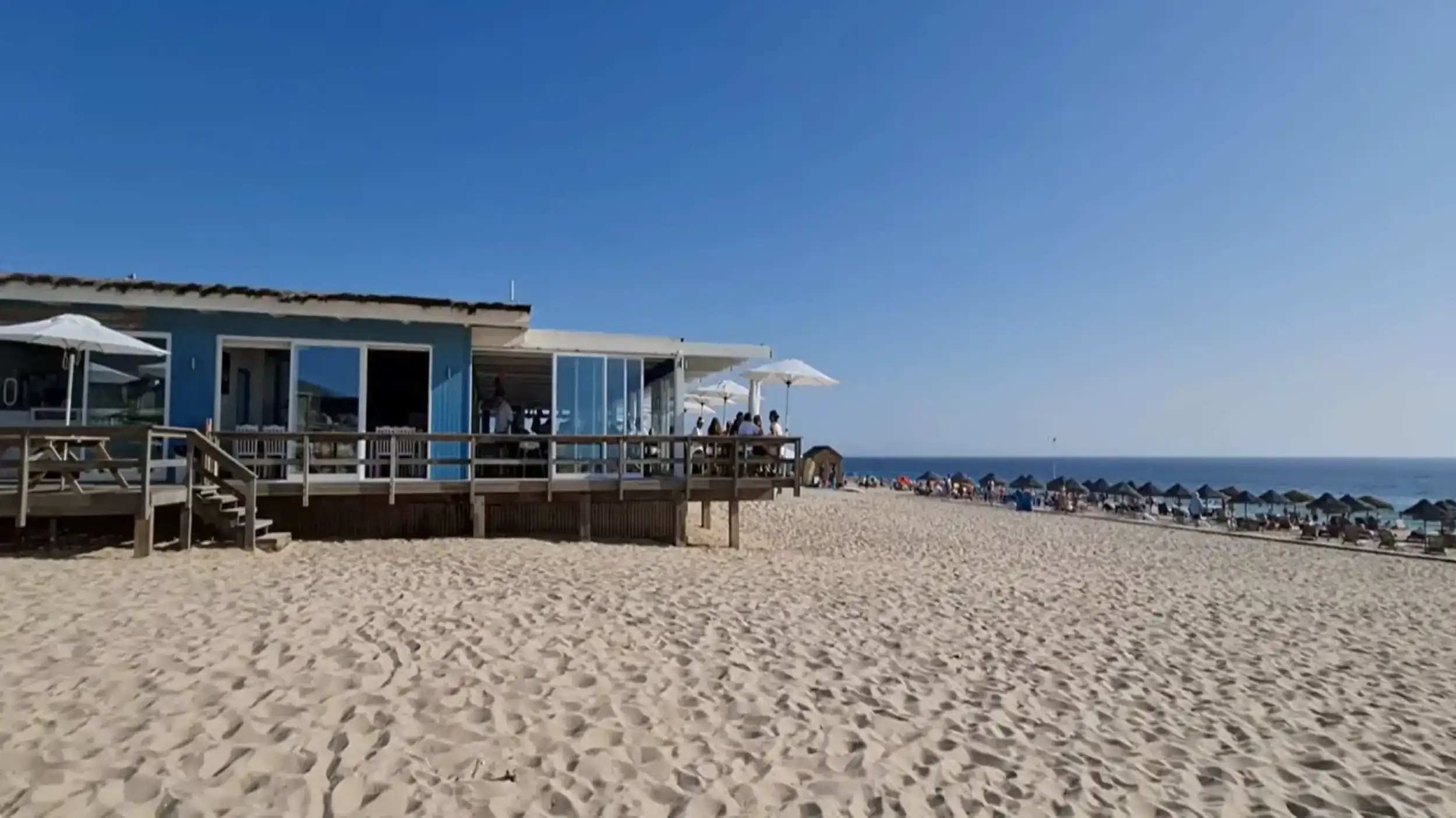
Comporta has built a strong reputation around a particular coastal atmosphere: pine forests, long Atlantic beaches, rice fields, and a carefully maintained village aesthetic. That combination works well for what it is. But the village itself does not carry much historical depth. Most of its identity belongs to recent decades.
Alcácer do Sal holds the older version of the same landscape. The same rice paddies extend around it, the same estuary supports the same birds and marine life, and the Atlantic beaches remain within reach. The difference lies beneath the surface. Successive civilisations arrived here because the combination of salt, navigable river, and fertile land made the location valuable long before the modern idea of the Alentejo coast existed.
Visitors who find Comporta appealing but want more than atmosphere tend to keep driving east. Alcácer do Sal is where the landscape acquires its longer story.
Getting Here from Comporta
The drive from Comporta takes around thirty minutes on the N253 heading east. The road follows the edge of the floodplain for much of the route, with rice fields visible on both sides and stork nests readable from the car well before the town appears.
Crossing the bridge provides the clearest view of the setting. Looking east, the river follows the flat valley into the Alentejo interior. To the west it widens toward the estuary and eventually the Atlantic beyond the dunes. The white town rising up the hill on the north bank makes the decision to stop feel straightforward.
There is no practical public transport connection from Comporta. A car is required.