The Comporta Coast runs for roughly sixty kilometres of Atlantic shoreline between the Sado Estuary and Melides. Seven villages, one agricultural estate, and a landscape that resists easy summary.
Most visitors arrive knowing Comporta by name. Fewer understand that the name belongs to a single village within a much larger system. The coast takes time to read. It rewards visitors who move through it slowly rather than those who arrive looking for a fixed point to settle.
The Geography That Shapes Everything
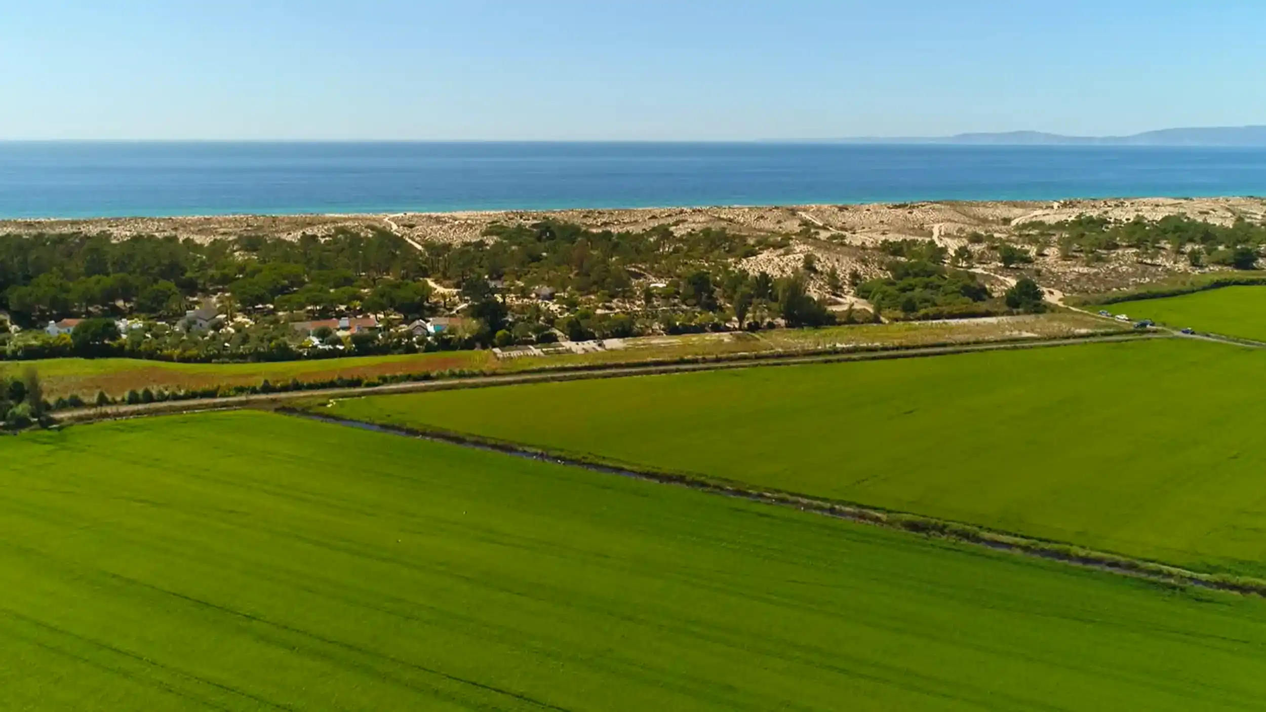
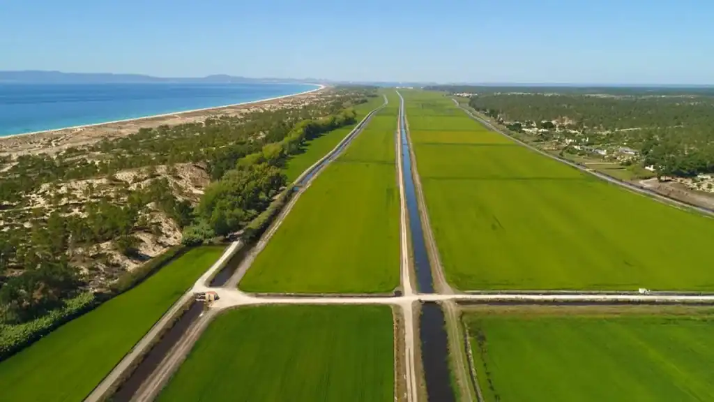
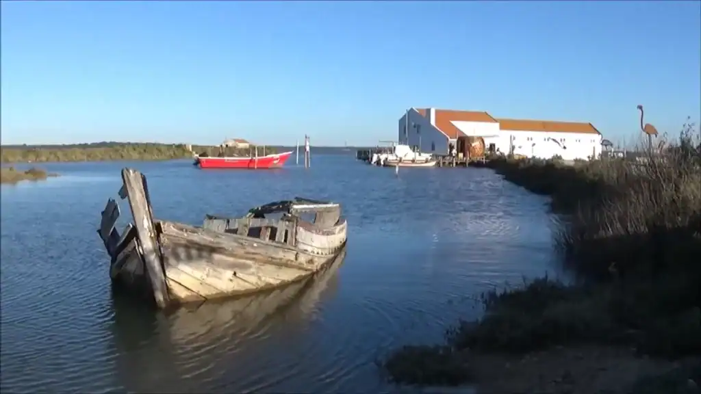
The road that runs through the coast sits between two very different bodies of water. To the east the Sado Estuary pushes deep inland, a tidal system that shaped the agricultural landscape around it. To the west a continuous belt of dunes and pine forest separates the villages from the Atlantic. Between them lies the working interior: rice fields, irrigation canals, marshland, cork oak stands, and the seven villages themselves.
The flatness of the terrain can be deceiving. The colours shift constantly across it. Water lying in the flooded paddies reflects the sky in wide, still panels. The dune line on the western horizon changes height almost imperceptibly as you drive south. The light behaves differently here than elsewhere in southern Portugal, partly because so much of the land surface is water for much of the year.
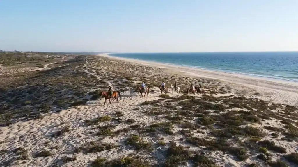
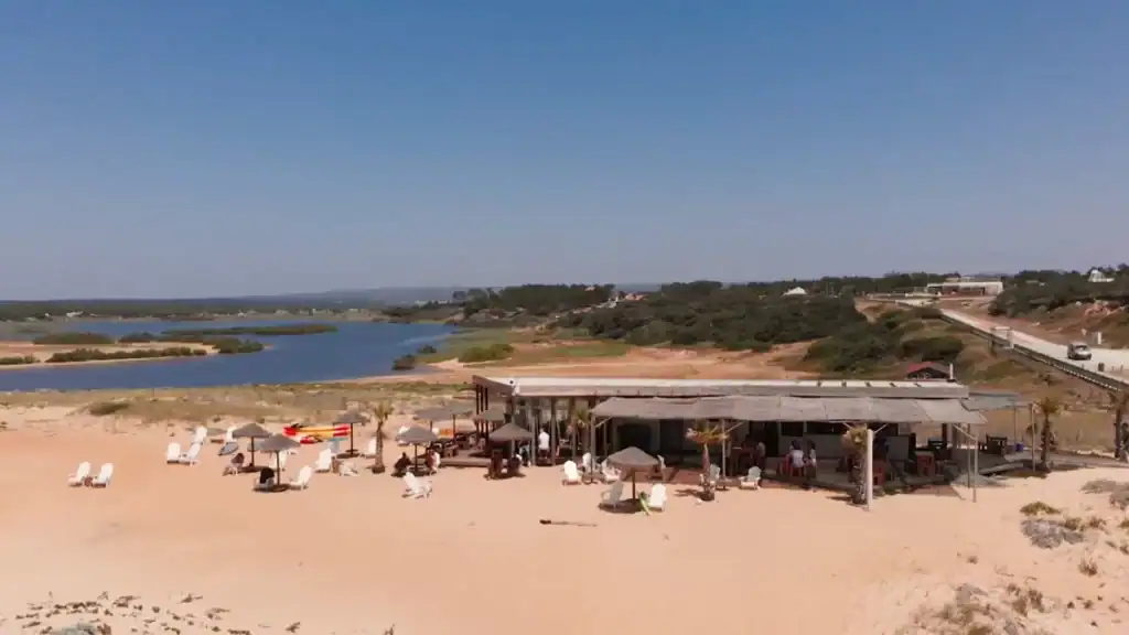
Reaching the Atlantic requires a short walk from wherever you park. The path crosses scrub vegetation, climbs the sandy rise of the dunes, and then delivers you onto a wide pale beach with no buildings visible along the horizon in either direction. That transition from agricultural interior to open ocean is one of the defining experiences of the coast, and it happens every time regardless of which beach you choose.
The Rice Fields and What They Reveal
Rice cultivation began here in the 1920s when the Herdade da Comporta drained and organised the marshland into irrigated fields. The scale of the operation explains the geometry of the landscape: large rectangular parcels separated by straight canals, not the gradual terracing of centuries but an engineered system imposed across the floodplain within a few decades.
Migrant workers came seasonally to plant and harvest the crop. Many settled permanently, and the villages grew from those communities. The agricultural history is inseparable from the social one. The people who live here year-round are largely descended from families who came to work the fields.
Sowing is now done by small aircraft scattering seed across the flooded paddies at low altitude. The rice matures through the summer into the intense green that appears in most photographs of the region, then turns gold at harvest in September and October. By winter many of the fields flood again, becoming shallow mirrors that stretch toward the dunes.
Moving through the interior by bicycle reveals the geography more clearly than driving. The relationship between paddies, canals, and the distant dune line becomes legible at a slower pace. The mosquitoes also become impossible to ignore in July and August. Anyone planning long summer evenings near the fields discovers the practical value of insect repellent quickly.
The Seven Villages
The seven villages that make up the coast sit close enough that visiting several in a single day is straightforward. Their characters are not identical, and understanding the differences helps with planning.
Carrasqueira
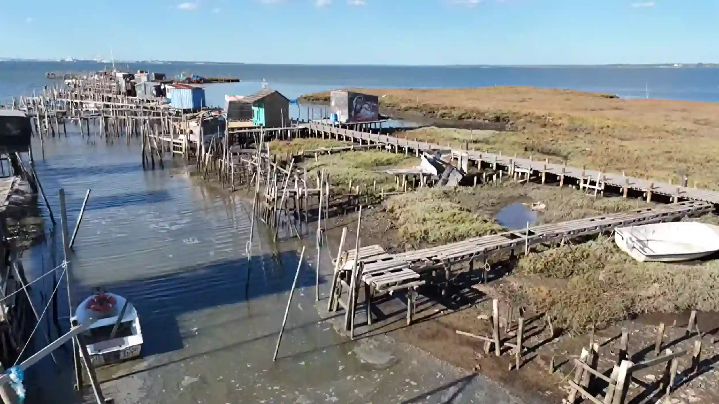
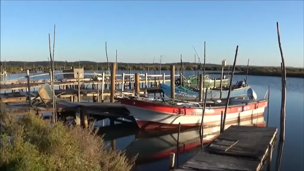
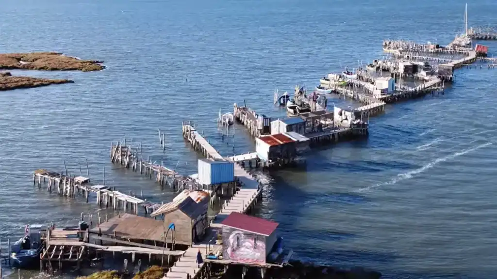
Carrasqueira sits furthest north, positioned directly on the Sado Estuary rather than facing the Atlantic. Its defining feature is the Cais Palafítico, a wooden pier built on stilts during the 1950s and 1960s so fishing boats could reach the water regardless of the tide. The structure zigzags across the mudflats in a line that looks precarious from a distance and feels it underfoot. The boards shift slightly as you walk. The small huts at the pier’s end still store fishing equipment, and birdlife gathers across the exposed mudflats at low tide.
Sunset photographers sometimes arrive in numbers. Outside the main season the pier can be nearly empty, which is the better time to visit. The full story of its construction and tidal logic is covered in Carrasqueira’s Palafitic Pier: A Comporta Coast Icon.
Comporta
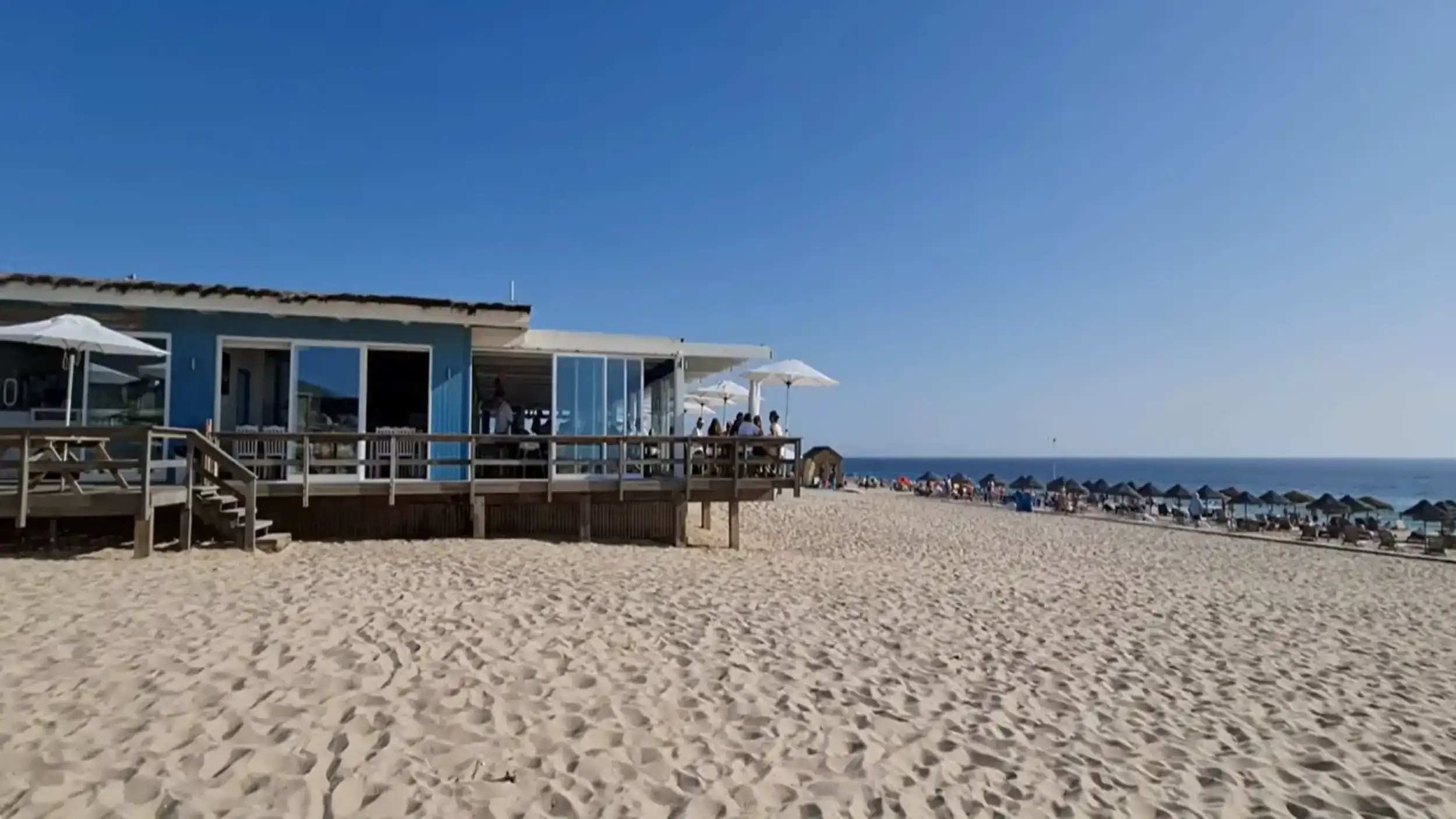
Comporta village acts as the informal centre of the coast, though it remains small. A short main street holds a few restaurants, the Museu do Arroz, and a handful of boutiques. The buildings follow the whitewashed low-rise style typical of the region. Strict building regulations keep development at least five hundred metres from the beach, which has preserved the village’s modest scale despite growing pressure from outside investment.
The beach sits roughly two kilometres away across the rice fields, requiring its own trip. Visitors who arrive expecting a coastal village with a seafront leave mildly surprised. Comporta village and Praia da Comporta are two distinct places with different characters.
Possanco, Torre and Brejos
Possanco sits a short drive from Comporta and functions largely as a residential settlement. A local restaurant and small ice cream shop attract passing visitors, but the village stays quiet. Torre and Brejos blend even more closely into the agricultural landscape, small clusters of houses surrounded by fields and canals with little visitor infrastructure.
Carvalhal
Carvalhal has a noticeably different atmosphere from the villages to the north. The beach faces stronger surf, and the area has drawn a younger crowd alongside several of the coast’s more established beach restaurants. Sublime Comporta, which opened in 2014 as the first hotel in the region, sits behind the dunes here. Its architecture uses natural materials and keeps a low visual profile, which set the tone for subsequent development along the coast.
Shops along the road through Carvalhal occasionally sell antiques and decorative objects, places where Lisbon families look for pieces to furnish their holiday houses.
Pego
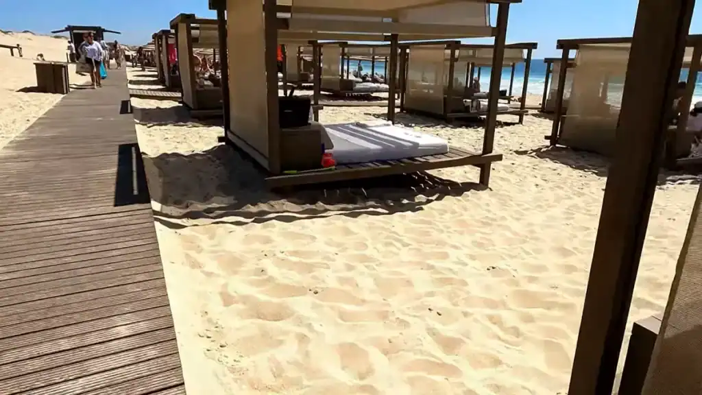
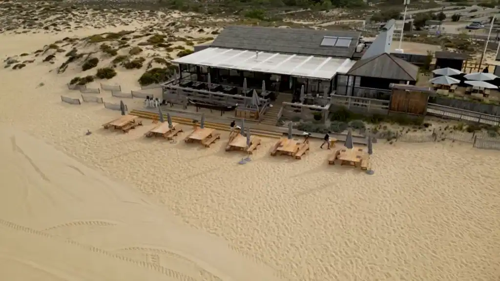
Pego marks the southern edge of the central villages. Roads from here lead to Praia do Pego and Praia do Carvalhal, where wooden beach restaurants sit back from the sand. The food at these places is well regarded. The prices reflect both the quality and the limited competition in the area. Visitors looking for more modest options often drive inland toward Alcácer do Sal.
Further south the atmosphere shifts as the road approaches Melides. A coastal lagoon interrupts the dunes here, giving the town a different relationship to the sea. In 2023 Christian Louboutin opened the hotel Vermelho nearby, a project that placed Melides on a wider international map almost immediately. The town itself remains small and largely local in character outside the orbit of the hotel.
The Atlantic Beaches and the Dune Belt
The dune belt runs almost continuously from Tróia down past Melides, forming a consistent barrier between the agricultural interior and the ocean. Reaching the beaches requires crossing it on foot from designated parking areas.
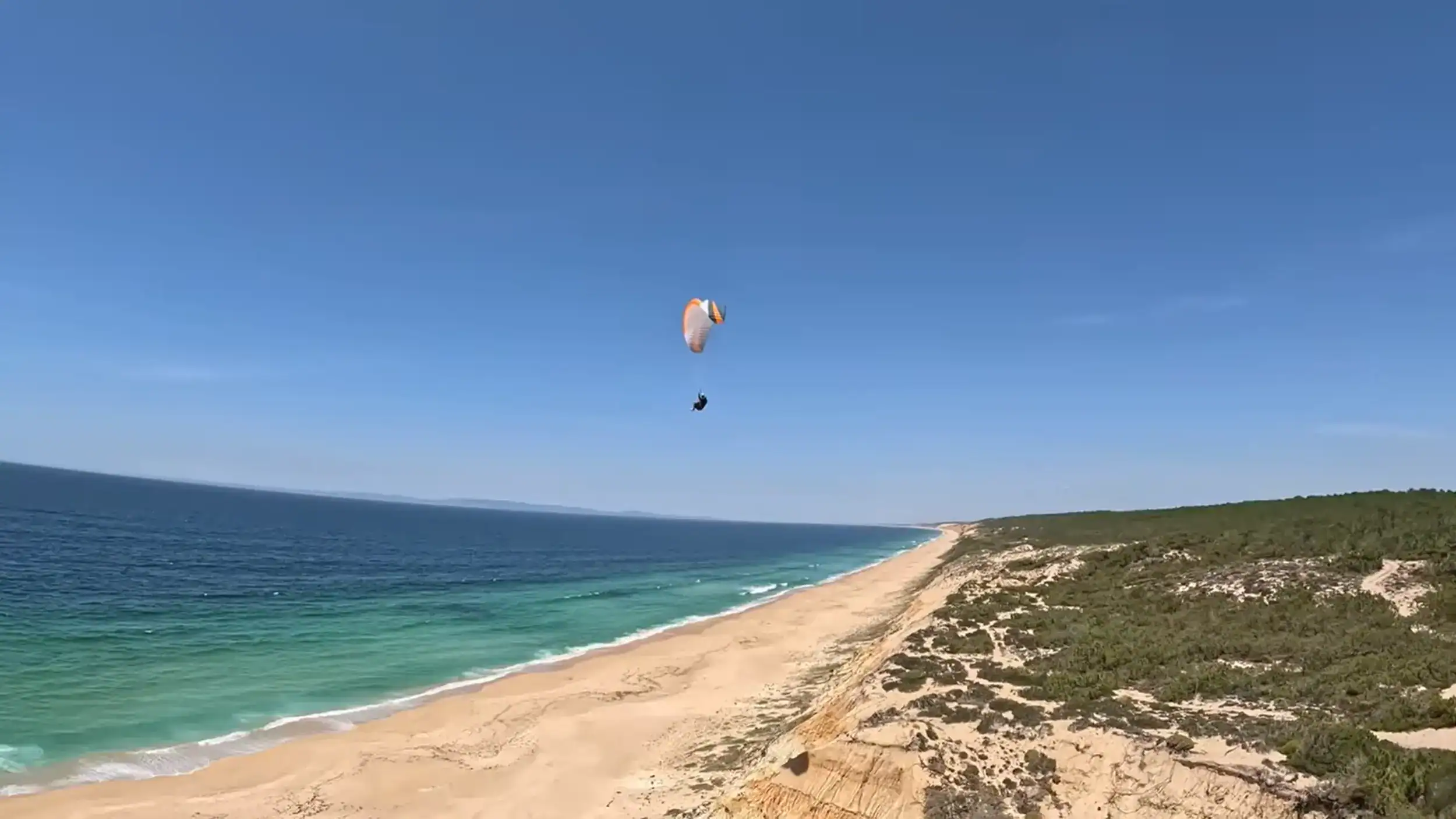
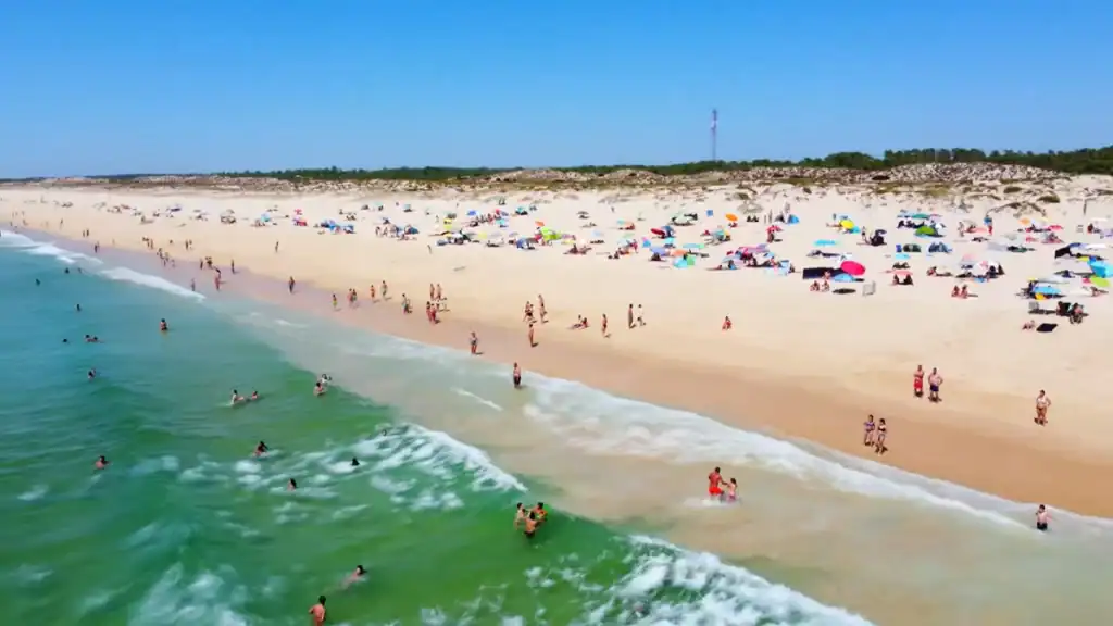
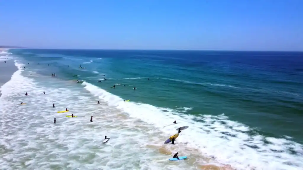
The effort is not strenuous. It is enough to thin the crowds slightly. Beyond the crest the Atlantic stretches across a wide band of pale sand. Water temperatures range from around sixteen degrees in early spring to twenty-two in late summer. The sea feels unmistakably Atlantic: clear, energetic, and cold for swimmers accustomed to warmer Mediterranean water. Surfers find the consistent swell more useful than the temperature.
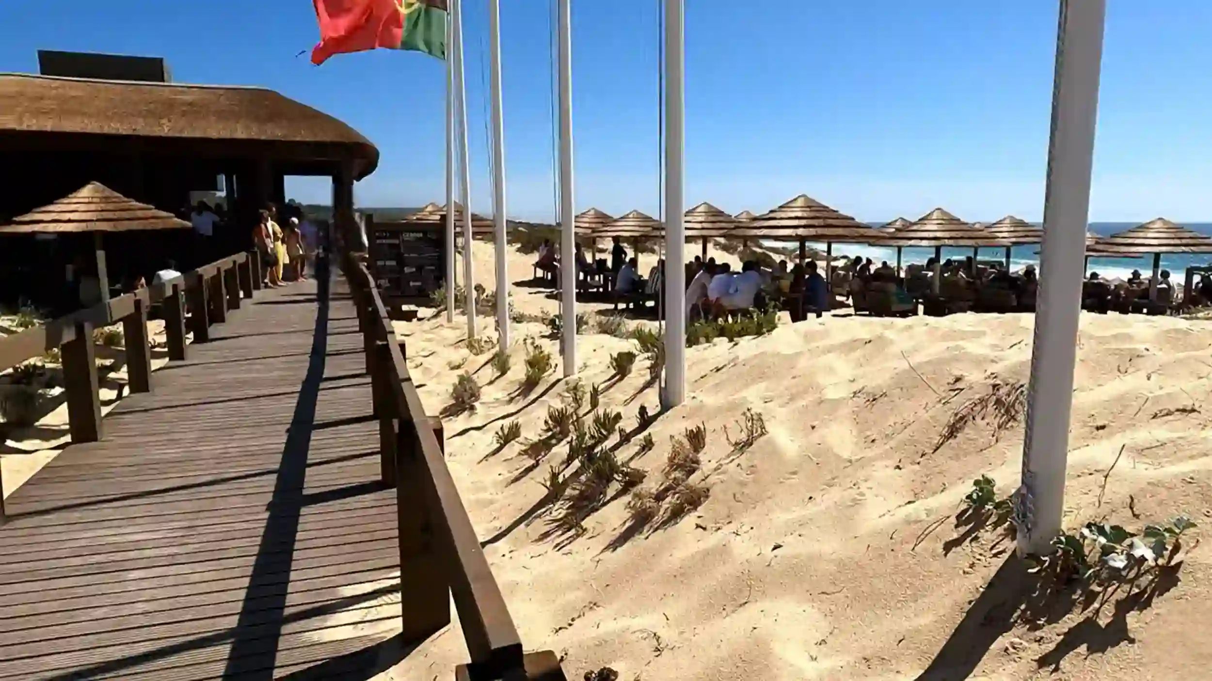
Building restrictions prevent permanent construction within five hundred metres of the shoreline. The seasonal wooden restaurants at Comporta, Carvalhal, and Pego stand well back from the waterline. Between them the beaches empty quickly away from the easiest access points. During winter it is possible to walk for several minutes without seeing another person.
Near Melides the coastline changes slightly. The cliffs around Praia de Galé Fontainhas introduce a more rugged scale compared with the long flat beaches further north. Beyond Melides, Praia da Aberta Nova sits on the open Alentejo coast, one of the least developed strands on the entire stretch.
Wildlife and the Estuary
The Comporta Coast sits within the Sado Estuary Nature Reserve, one of the most significant wildlife areas in Portugal. The estuary supports a resident population of bottlenose dolphins known locally as roazes-corvineiros. Unlike most dolphin groups in European waters, these remain year-round. Boat trips from Setúbal offer reliable sightings, and passengers on the Setúbal to Tróia ferry occasionally spot them during the crossing.
More than two hundred bird species have been recorded across the estuary and surrounding marshes. At low tide the mudflats near Carrasqueira attract Eurasian spoonbill, whimbrel, dunlin, greenshank, and curlew. Herons and egrets work the rice fields and marshland through much of the year. Short-eared owls appear in winter. Marsh harriers pass through during migration.
White storks nest across all seven villages, usually on rooftops or telegraph poles. Their nests are visible year-round once you start looking for them. Flamingos feed within the estuary, particularly visible from boats travelling upriver toward Alcácer do Sal.
What the Coast Is Not
The Comporta Coast is not a resort. There is no hotel strip, no nightlife district, and no obvious centre. The villages are spaced far enough apart that a car is effectively essential. Public transport exists but runs infrequently.
Prices reflect the limited development and the growing reputation of the area. Beach restaurants charge accordingly, and accommodation within the coast can be expensive by Portuguese standards. The coast is no longer unknown. Summer months bring visible crowds to the northern beaches and a recognisable social scene to some of the beach restaurants.
The landscape does not resemble the Algarve. There are no dramatic rock formations or sea caves. What the coast offers is scale and atmosphere rather than spectacle. The flat agricultural interior can feel uneventful at first glance. The beaches and the estuary reward patience more than they reward a packed itinerary.
How the Landscape Changes Through the Year
The coast looks different in every season, and the difference is significant enough to affect what kind of visit is possible.
June brings the rice fields to their most vivid green. Daylight hours are long, the beaches are comfortable, and the peak crowds have not yet arrived. It is the clearest month to understand why the landscape has the reputation it does.
July and August form the high season. Northern beaches fill quickly, beach restaurants require advance booking, and the mosquito population near the paddies reaches its peak. The social scene at the beach clubs operates at full capacity. For visitors who want that atmosphere, this is the right time. For those who want the landscape, it is the most demanding.
September and October bring harvest. The fields turn gold and the light softens noticeably across the estuary. Visitor numbers fall while the sea stays warm enough for swimming. This is the month when the coast reveals its full range most easily, the Atlantic still swimmable and the agricultural landscape at its most photogenic.
Winter empties the coast almost entirely. Many of the paddies flood again. Birdlife increases across the estuary. The Carrasqueira pier, busy with photographers on summer evenings, stands nearly silent on winter afternoons. The Atlantic wind becomes a more constant presence along the dune belt.
Spring begins the cycle again. Water recedes from the fields, preparation for planting starts, and the green returns first in patches and then across the entire interior. The coast moves through these changes on its own schedule, largely indifferent to when visitors choose to arrive.
Across the Comporta Coast
Praia da Aberta Nova: Comporta’s Wildest Atlantic Beach
Comporta Village Feels Smaller Than You Expect
Carrasqueira’s Palafitic Pier: A Comporta Coast Icon
Comporta Rice Fields: How the Landscape Changes by Season