The Convento de Santa Clara sits on a rise above the Rio Ave, founded in 1318 and still standing above Vila do Conde more than seven centuries later. The aqueduct that supplied it stretches four kilometres across the landscape to reach it.
Together the two structures are the most significant things to see in Vila do Conde. Understanding what they are, how they relate to each other, and what the hill shows you makes the visit considerably more useful.
The Hill and What It Shows You
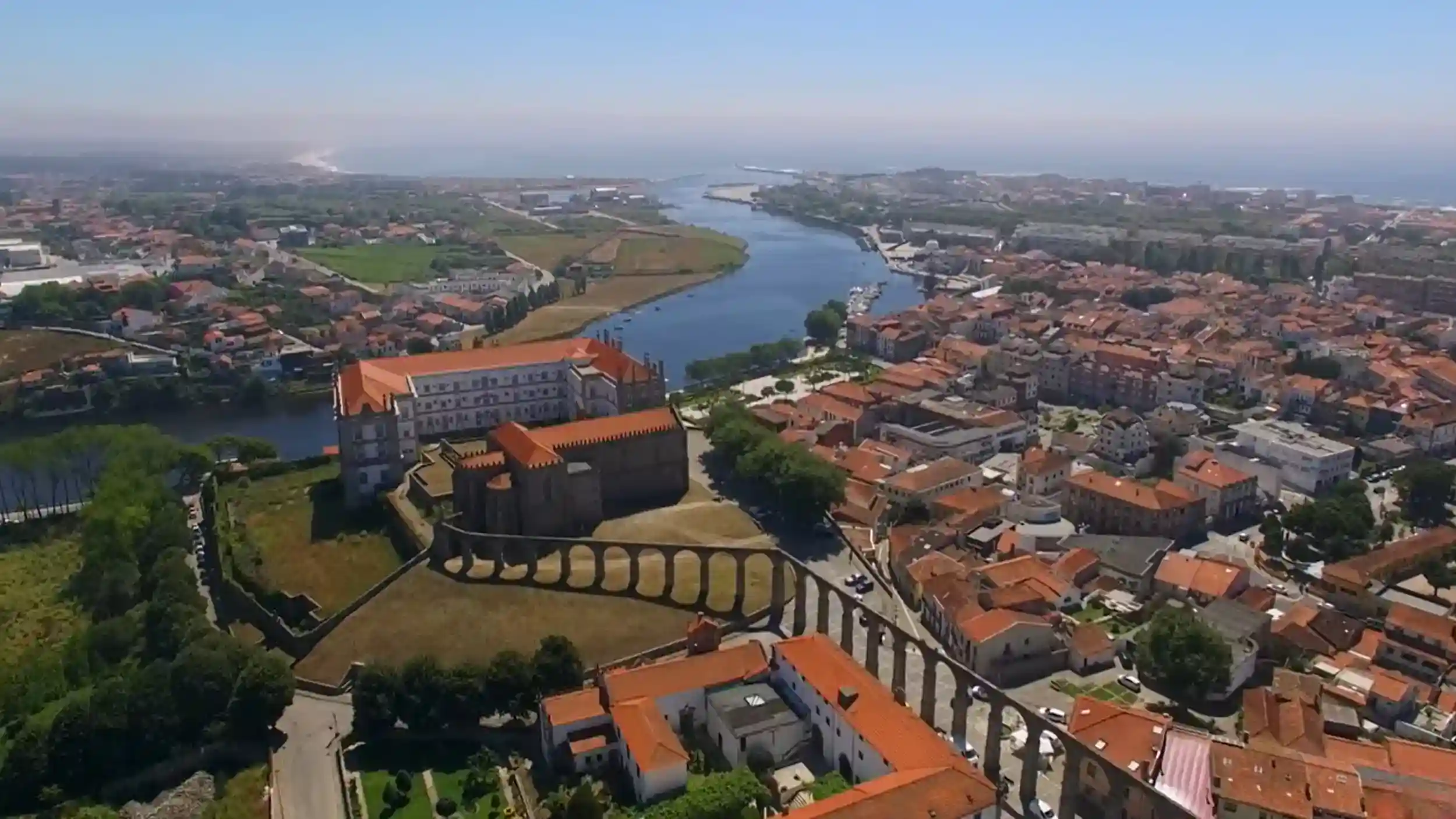
The elevation above the town is modest but enough. From the hilltop the layout of Vila do Conde becomes readable in a way it is not from street level. The older streets converge toward the river. The estuary opens to the west. Beyond the sandbar where the Rio Ave meets the sea there is open Atlantic.
On clear days the view takes in the river curve, the historic centre rooftops, the pine-backed dunes to the north, and occasional surf lines offshore when conditions are rough. The position makes clear how the settlement relates to its two bodies of water, the river and the sea, and why a community established itself here in the first place.
The hill has older occupation beneath the convent. A castro existed here before Roman presence in the region. Later settlement continued to use the same elevated point above the river and sea junction. The convent was founded on a site that already had centuries of use.
The Monastery of Santa Clara
The building covers a large footprint on the hilltop. It was one of the larger and wealthier female convents in Portugal during its active period, and the scale is evident in the size of its internal spaces and the extent of the complex.
The Building’s Layered History
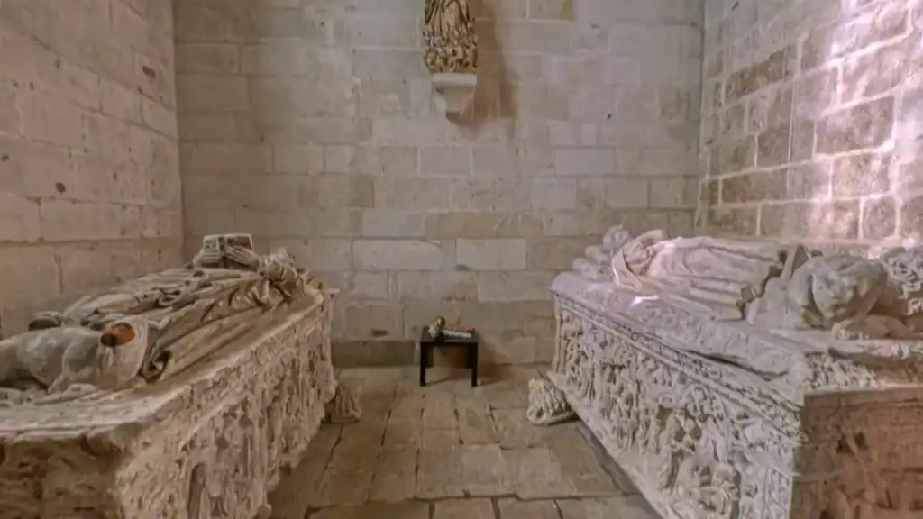
The original Gothic structure remains, with Manueline additions and later Baroque and Rococo modifications accumulated over several centuries. The church includes multiple construction phases that are readable in the changes of style and material across its interior. The tombs of the founders, Afonso Sanches and Teresa Martins, are located in a chapel dated 1526.
The west-facing rose window looks toward the town. The cloister courtyard receives direct morning light. Next to the convent stands the Convento de São Francisco, built later to support the enclosed religious community. Both buildings form a combined architectural presence above the town.
Current State and Access
The convent was closed during nineteenth-century religious suppression and later reused as a courthouse. It is currently in conversion to a hotel. The structure remains largely intact despite these successive changes in use.
Access to the interior is limited during the conversion period. The exterior, the churchyard, and the hilltop grounds remain accessible. The view from the grounds is available without entering the building, and the aqueduct approach route is walkable at any time.
The Aqueduct
The convent required a reliable water supply, which was difficult on an elevated site. Early supply relied on a waterwheel system and manual work drawing from a cistern inside the complex. That system was limited in capacity and the problem persisted for centuries.
In 1626 a plan was made to build an aqueduct from a spring at Terroso in Póvoa de Varzim. The project stopped after engineers determined the natural gradient was insufficient to maintain flow. The problem was not solved easily.
How It Was Built
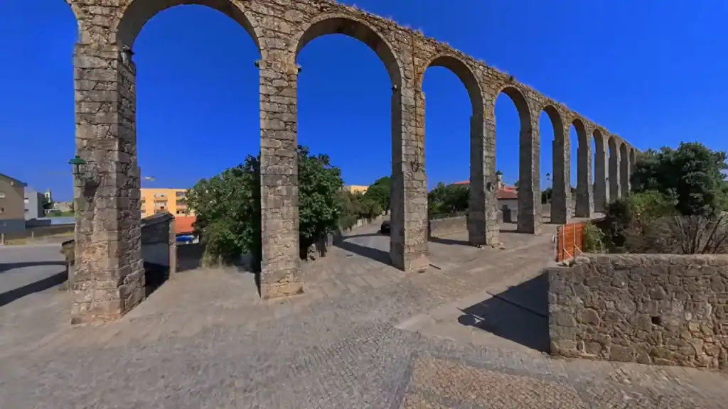
The project resumed in 1705 and was completed in 1714. The final design used a continuous series of arches to maintain water flow by gravity across a distance of roughly four kilometres. The structure includes 999 arches, though some counts vary depending on remaining sections. Each arch is relatively simple in construction. The effect of the whole is considerable.
The aqueduct connects the spring source to a fountain within the convent complex. It crosses farmland, residential areas, and older agricultural plots without interruption or change in direction. It remains standing and is traceable across the landscape from multiple points in the town. The convent it supplied no longer functions as a religious institution. The aqueduct still stands.
Walking Up From the Town
The convent is accessible on foot from the historic centre in around fifteen minutes. The route rises gradually rather than steeply. The aqueduct appears first in sections as it crosses residential streets on its way toward the hill, running through built-up areas before transitioning into older land near the base of the rise.
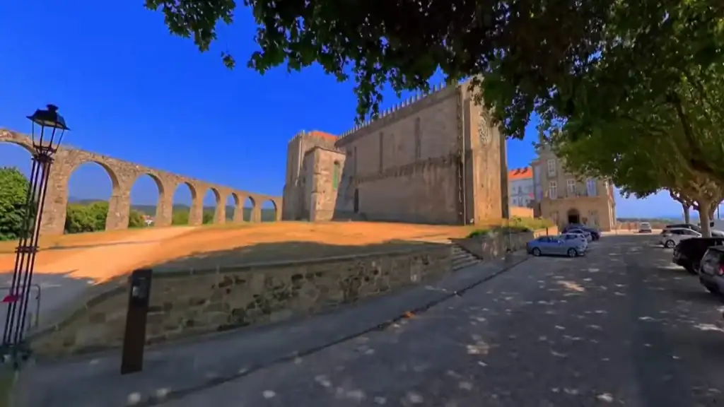
From some angles on the approach, the aqueduct aligns visually with the convent walls behind it. That alignment is one of the clearest moments when the relationship between the two structures becomes apparent. The final approach opens into the area in front of the church, where the full extent of the complex becomes visible for the first time.
The walk is short in distance and includes a steady incline. The streets passed through on the way up predate the convent and give a layered sense of how the town developed around the hill rather than simply below it.
The View From the Hill
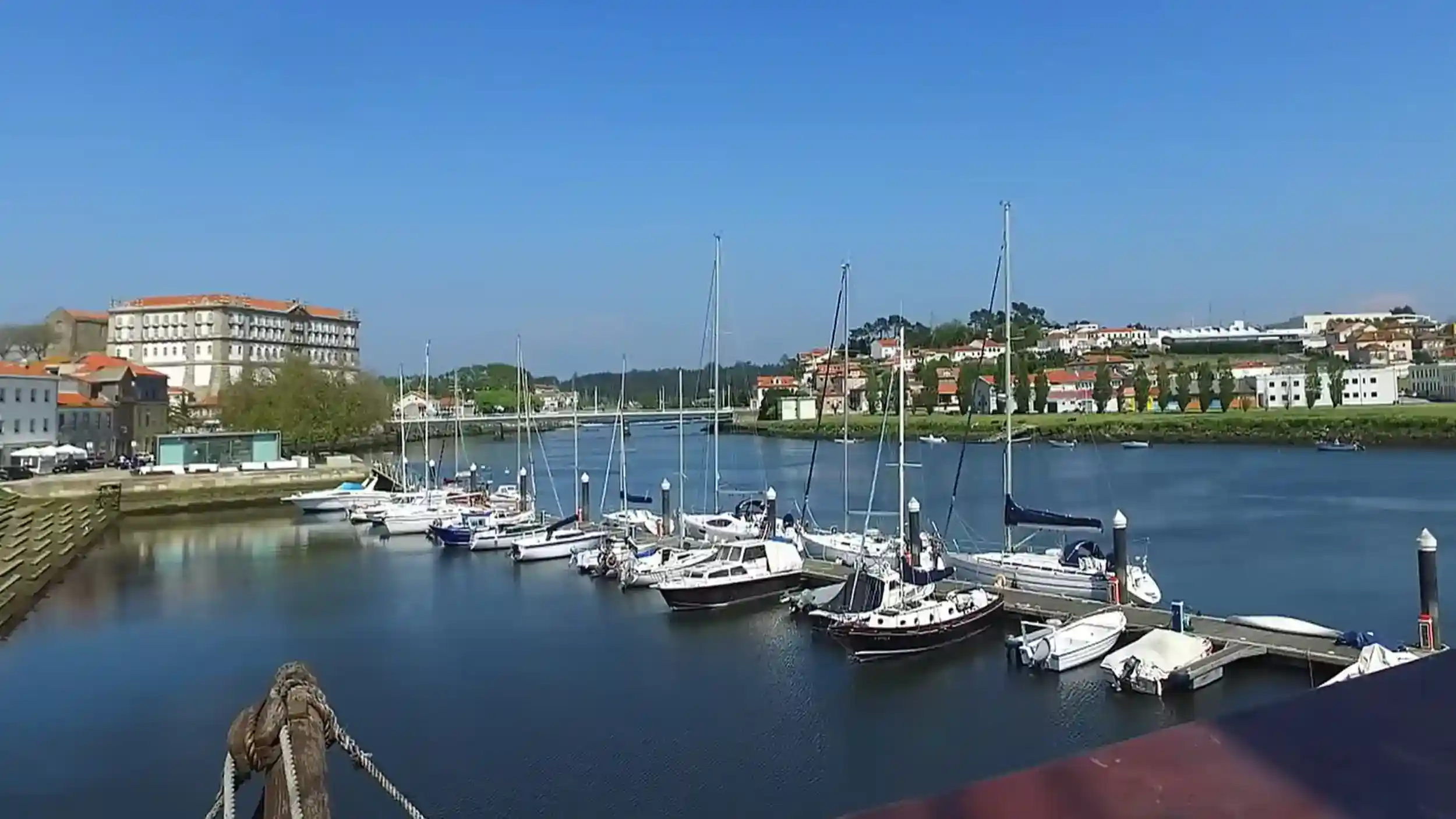
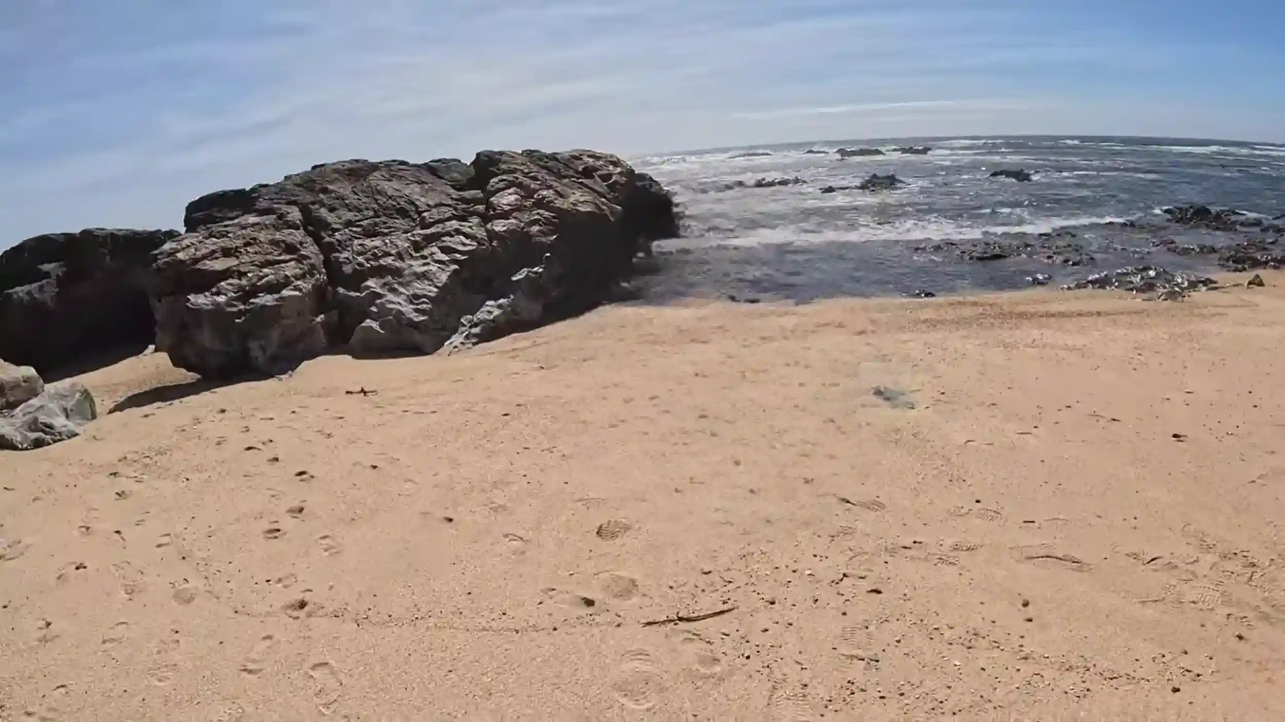
From the hilltop the River Ave curves through the town toward its mouth. The estuary sits directly ahead of the river channel with the coastal edge beyond. The old shipyard area near the water has the replica caravel visible when moored. The coastline extends north into dunes backed by pine forest, forming a continuous strip between the town and the Atlantic.
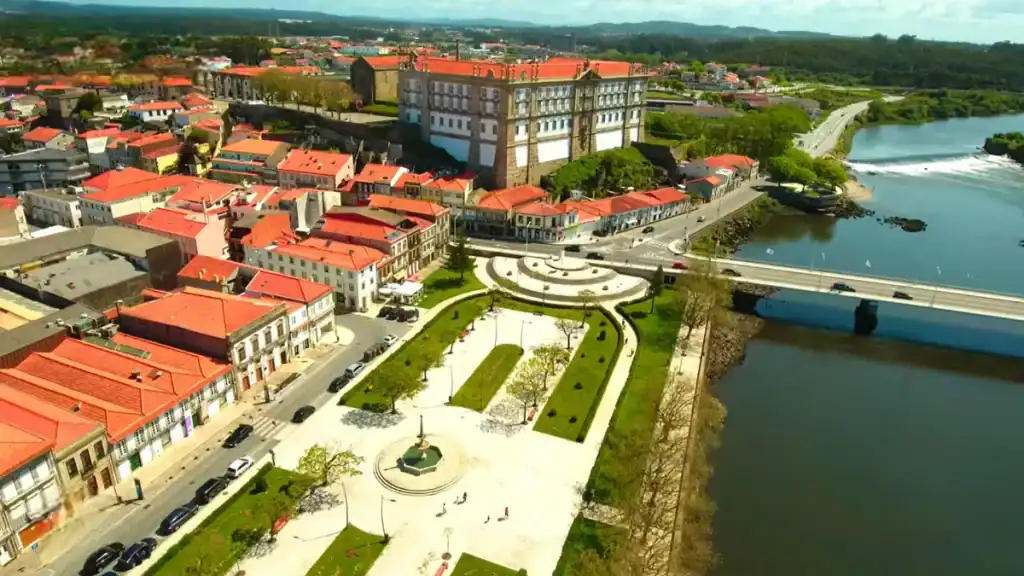
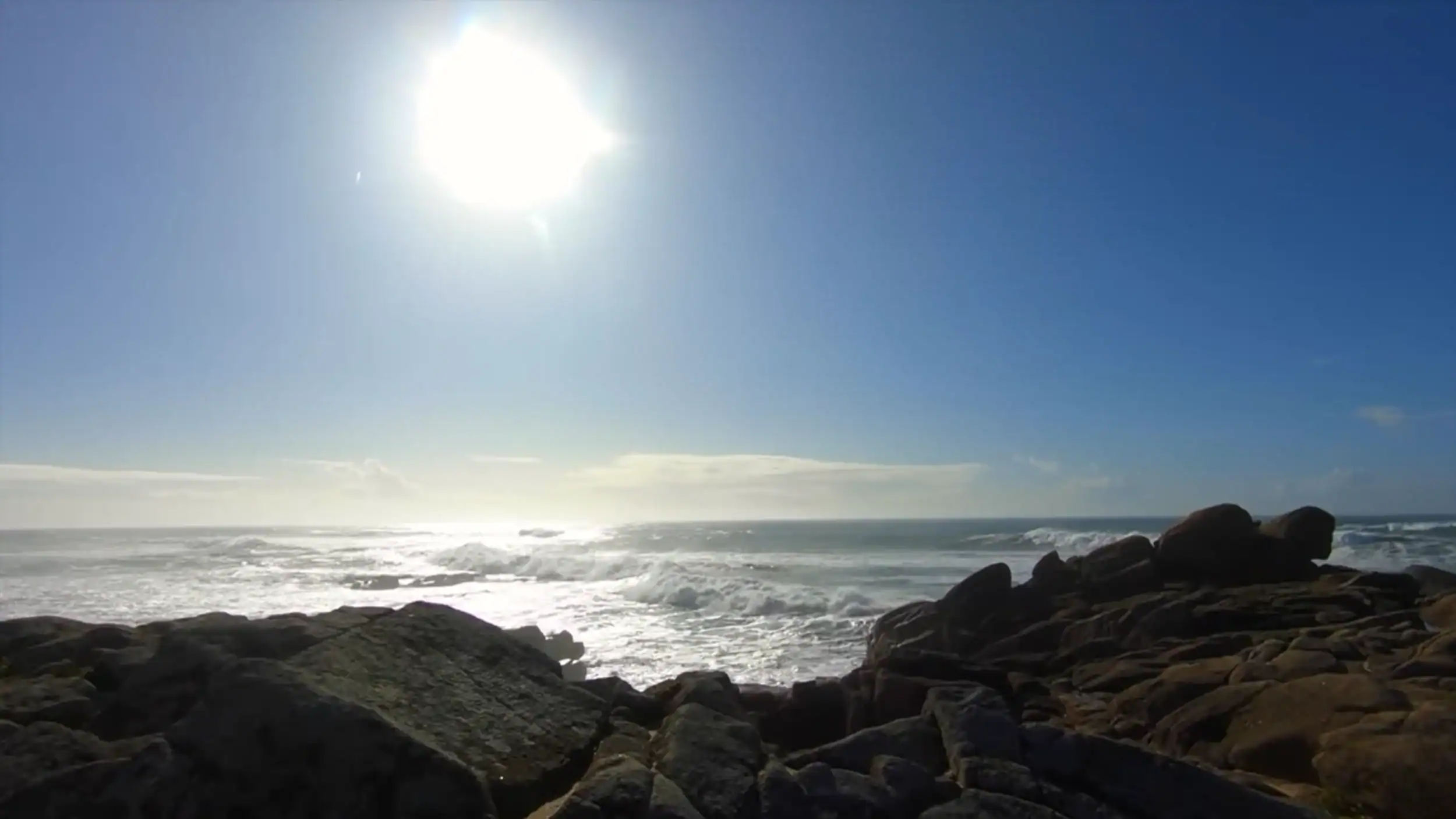
Visibility changes with weather. In clear conditions offshore surf lines are visible from the hill as distinct white lines against darker water. In low cloud the sea disappears entirely and the town below becomes the whole picture.
From this position the town appears more compact than it feels at street level. Streets converge toward the river, church towers and rooftops form a continuous pattern, and the aqueduct continues across the residential edge of town into the distance. The 999 arches run without interruption toward the spring at Terroso, carrying nothing now except their own weight and the record of what it took to solve a water problem on a hill in 1714.